
The stratosphere plays host to some of Earth’s most spectacular weather. During sudden stratospheric warmings (SSWs), the strong circumpolar winds of the stratospheric polar vortex break down and even reverse direction entirely. Frigid air pours out of the Arctic and causes prolonged deep freezes in North America and Europe.
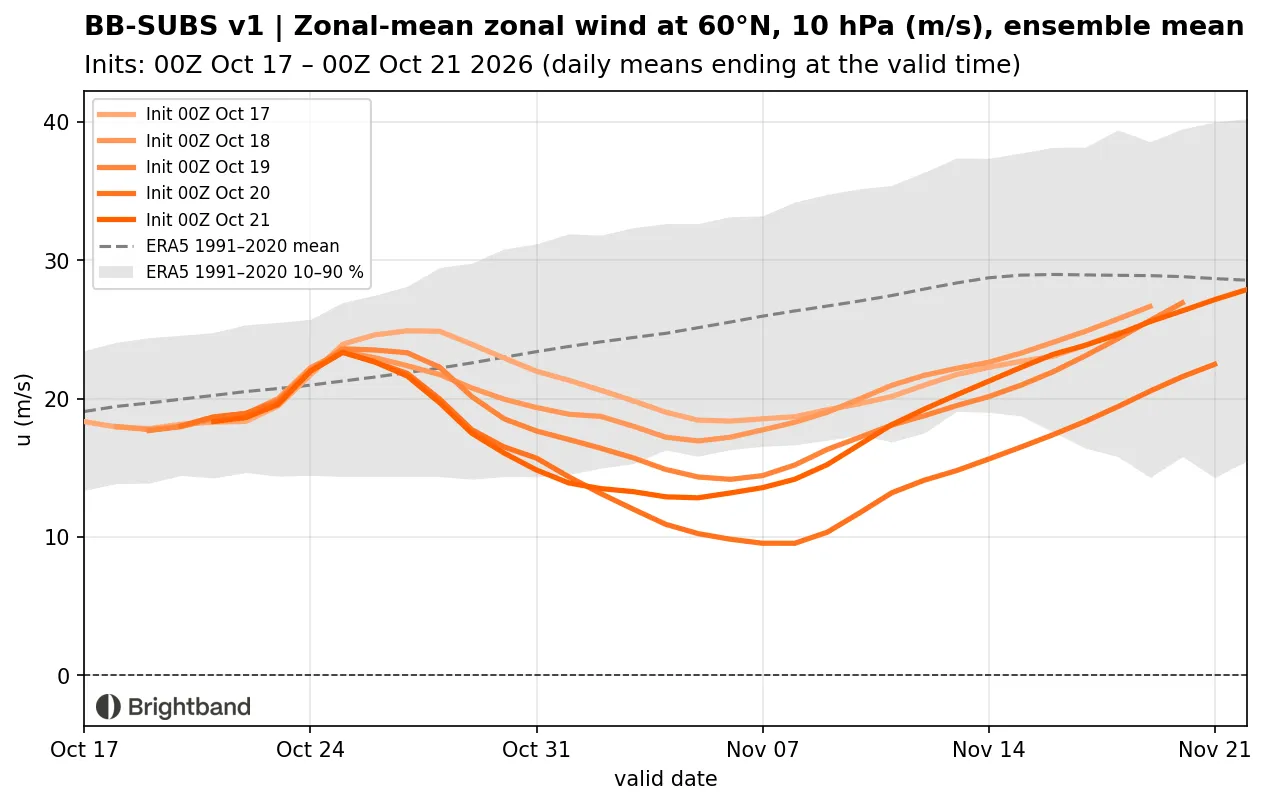
Yet even a polar vortex that weakens, but doesn’t break down entirely, can precede cold wintertime conditions in the Northern Hemisphere. While today’s polar vortex winds are typical for this time of year, some forecasts are predicting an unusually early weakening in the coming weeks. This has been linked to the ongoing Scandinavian-Ural block, a persistent large area of high pressure that can deflect vast quantities of energy upward and into the stratosphere, disrupting the polar vortex.
At Brightband, our 100-member subseasonal ensemble, BB-SUBS, has been tracking this development during the last few days. With the Scandinavian-Ural block in place, the ensemble mean forecast of the vortex wind speed has become progressively weaker, currently bottoming out two to three weeks from today.
BB-SUBS is operational now, running once daily out to 32 days. If you are interested in what we believe to be the most accurate subseasonal forecast in the world, you can find more information at www.brightband.com/data/subs. Reach out to us to try it out!