What Does October Hold in the Atlantic? AI Models Discussion 10-6-2025
We are coming down the home stretch of the Atlantic season, with a little less than 2 months to go til the season is officially over. While things have cooled off since Humberto and Imelda, there are still a few areas that bear watching over the next week or two. We’ll go through them one-by-one.
Invest 95L
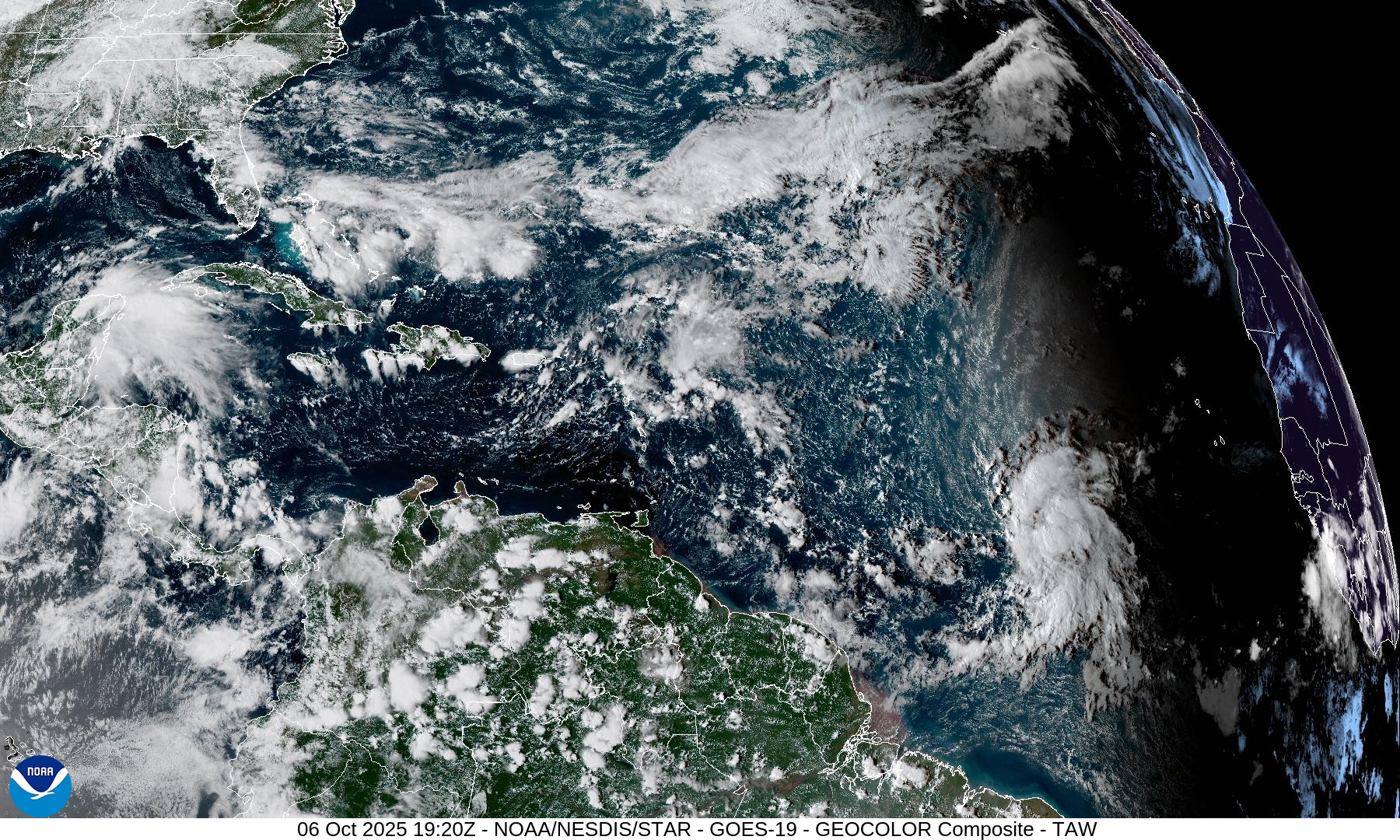
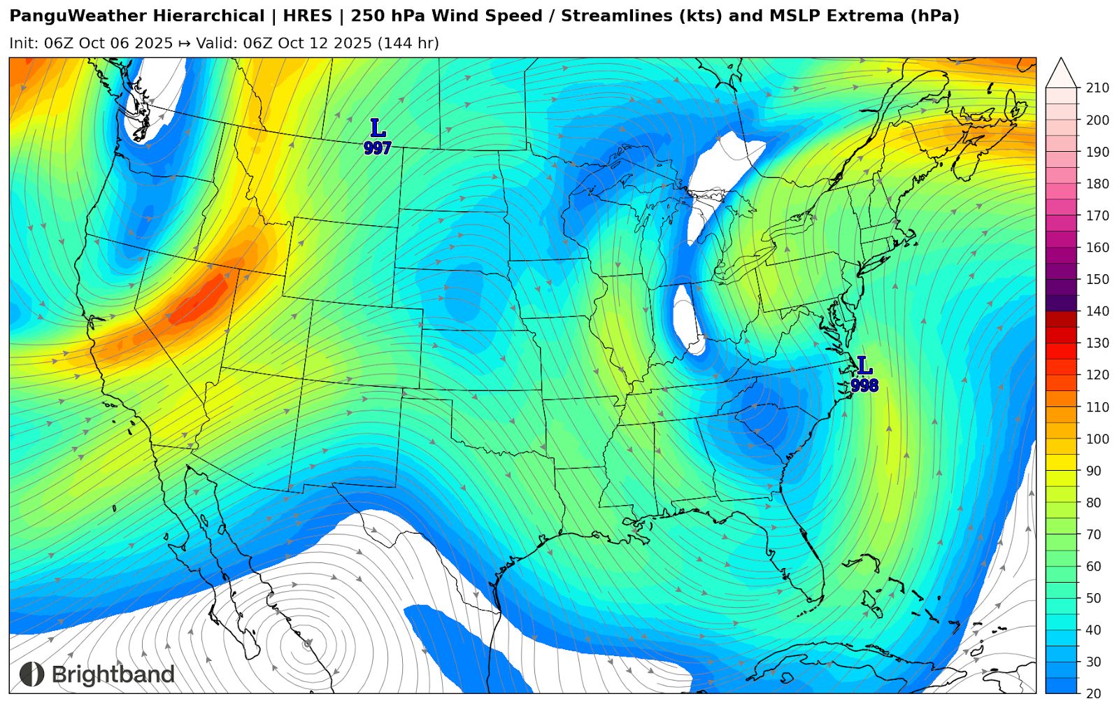
The main system of interest across the Atlantic for the next several days is Invest 95L over the Central Atlantic. NHC is giving it a 70% chance of development in the next 7 days. The environment looks marginal for development as it has for most of the year in the Atlantic. Upper level winds are favorable right now, but some fast mid-level flow (due to ridging to the north) is leading to shear. Closer to the islands, upper level winds out of the Southwest (Figure 1) may become less favorable for development.
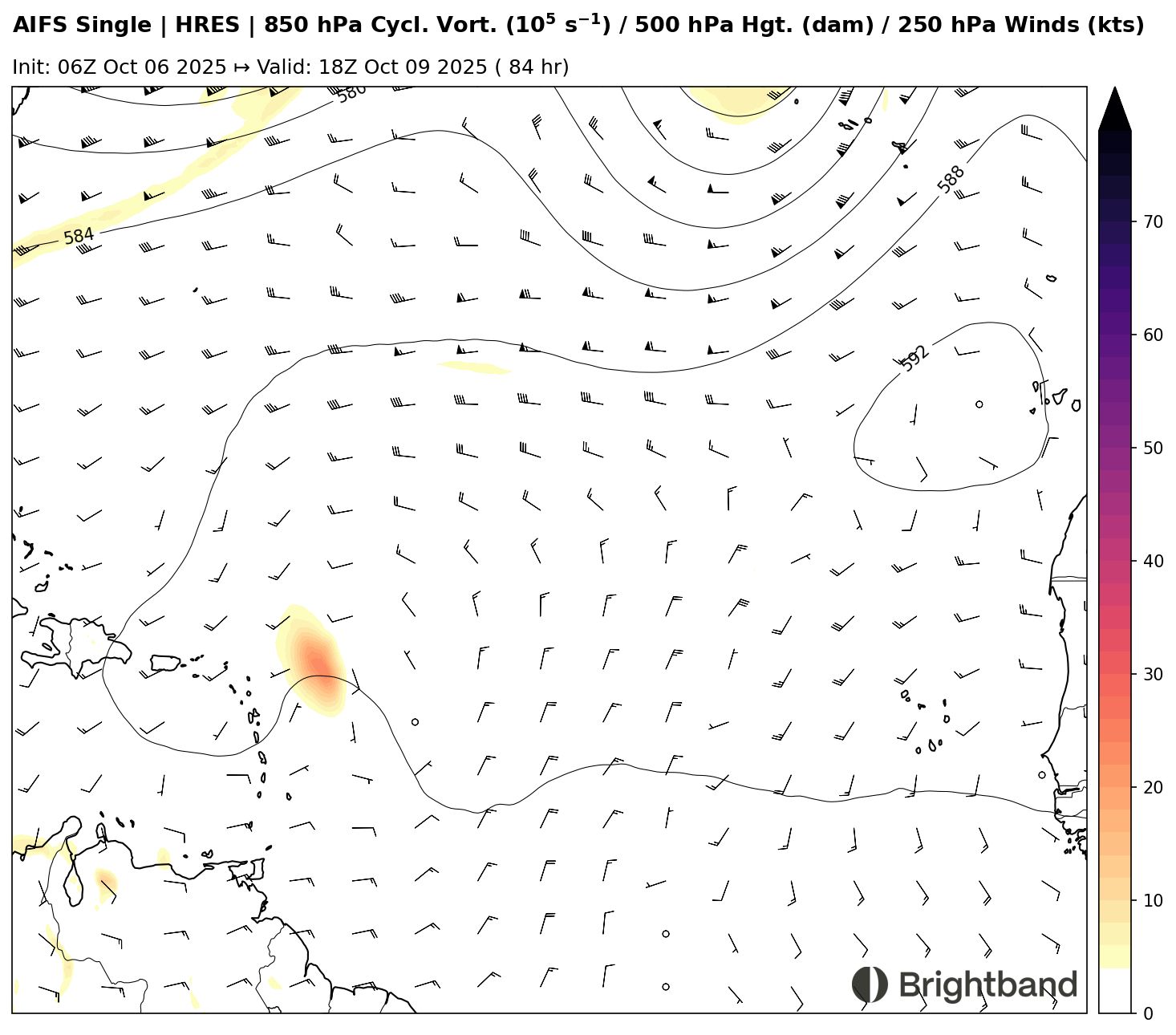
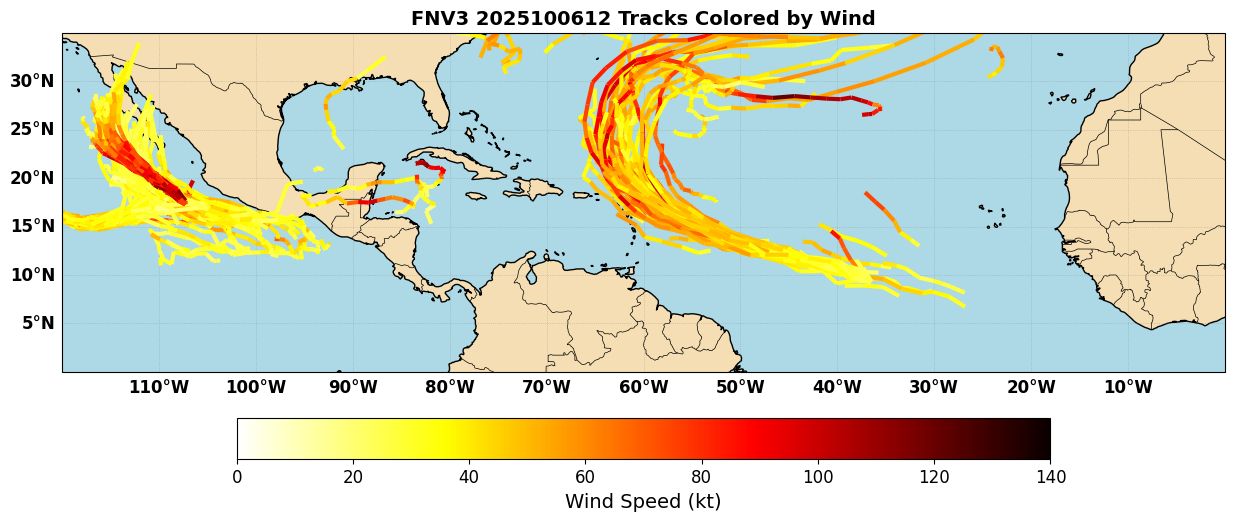
The Lesser Antilles should keep a close eye on this system. Right now most models and ensembles are showing a close miss to the northeast (Figure 2), but it would not take a big shift for some of the islands to be impacted, particularly places like Antigua/Barbuda and St. Martin. Right now the recurve looks to be East of Bermuda, which would be good news after they just got impacted by Imelda. It is interesting to note that stronger members of the ensemble seem to be on the left side (likely stronger ridging), so that’s something to monitor.
Coastal Low
Models are starting to lock onto a strong coastal low developing off the Southeast Coast by next weekend, potentially bringing strong easterly flow and coastal flooding to the Carolinas and Mid-Atlantic region (Figure 3).
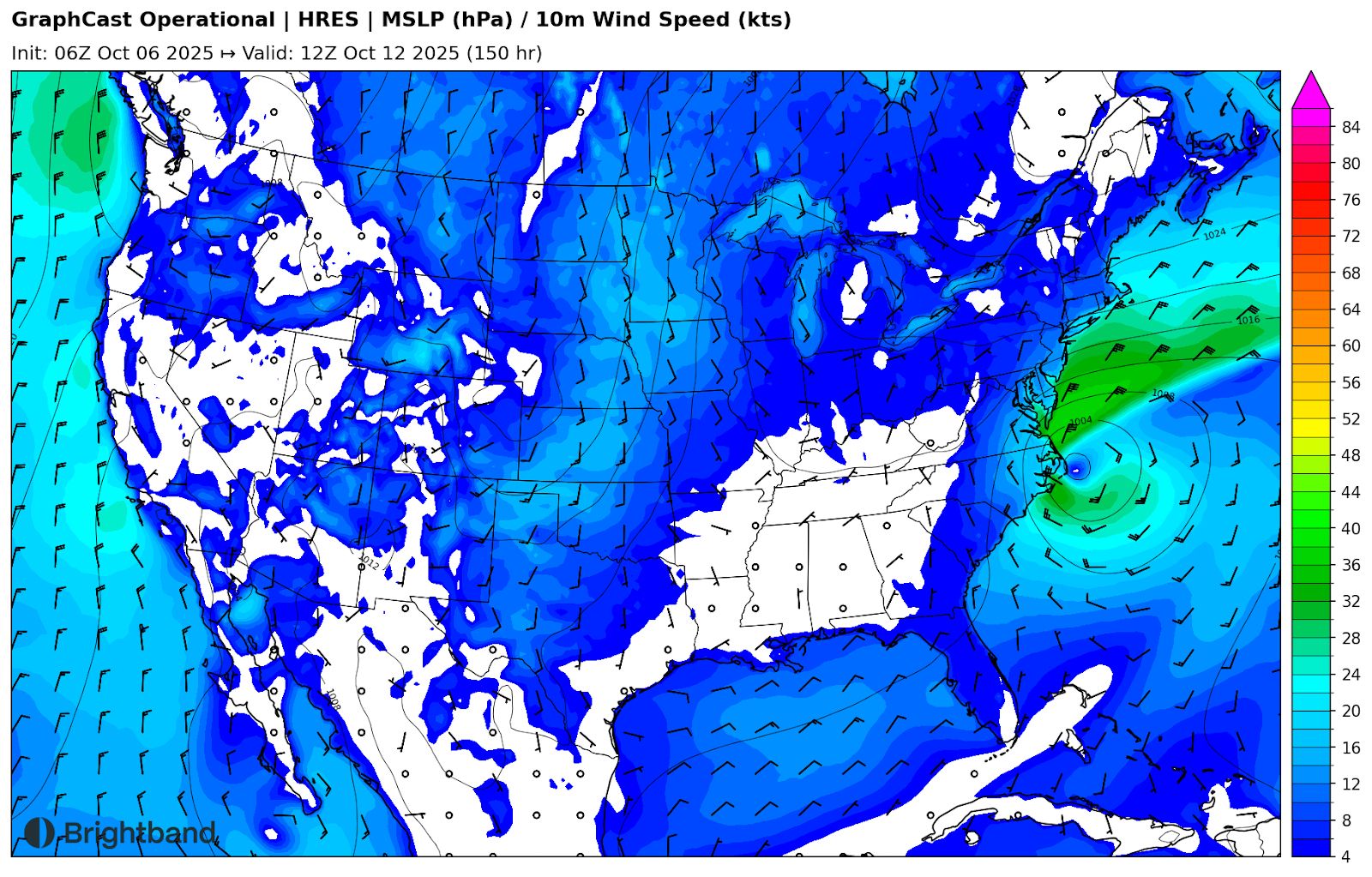
While this could certainly be an impactful system, right now I think that it is most likely to be non-tropical. Almost all of the forcing for low pressure seems to be from divergence in the left exit/right entrance region of two jet streaks ahead of the trough (Figure 4) - a classic winter/cold-core low setup.
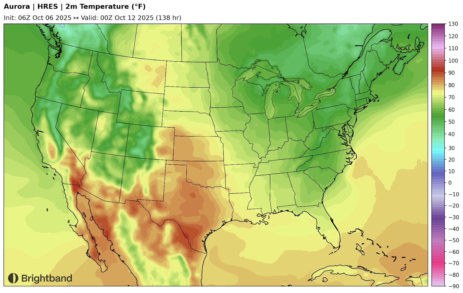
In addition, temperature forecasts clearly show a frontal setup, with warm air surging from the SW Atlantic towards the coast and cold air plunging southwest (Figure 5). Regardless of the tropical status though, this could be a threat to bring strong winds, heavy rain, and surge to the coastal regions.
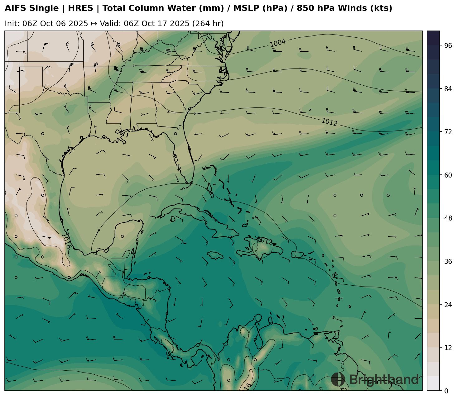
Long-range Caribbean/Central American Gyre?
Over the next two weeks or so, the MJO will move into the Caribbean and Western Atlantic. This will support large-scale rising motion, and potentially help lead to the formation of a Central American Gyre (CAG), which is a large-scale monsoonal circulation over/near Central America, with enhanced rainfall, increased vorticity, and lower pressures (Figure 6). Sometimes, smaller-scale vortices will form within this CAG and turn into tropical cyclones. It’s hard to predict at long-range whether these smaller lows will form on the East Pacific side, Caribbean side, or even over land (which would limit tropical development). Right now AI models are not overly enthusiastic about TC development in the next 10-12 days (Figure 1), but we’ll see if that changes as this gyre sets up over time. Either way, flooding rainfall could be a concern across Central America over the next few weeks.