Atlantic and Pacific Model Forecast Discussion 9-17-2025
The tropics are waking up a little bit, especially in two basins that have been less active recently: the West Pacific and Atlantic.
West Pacific
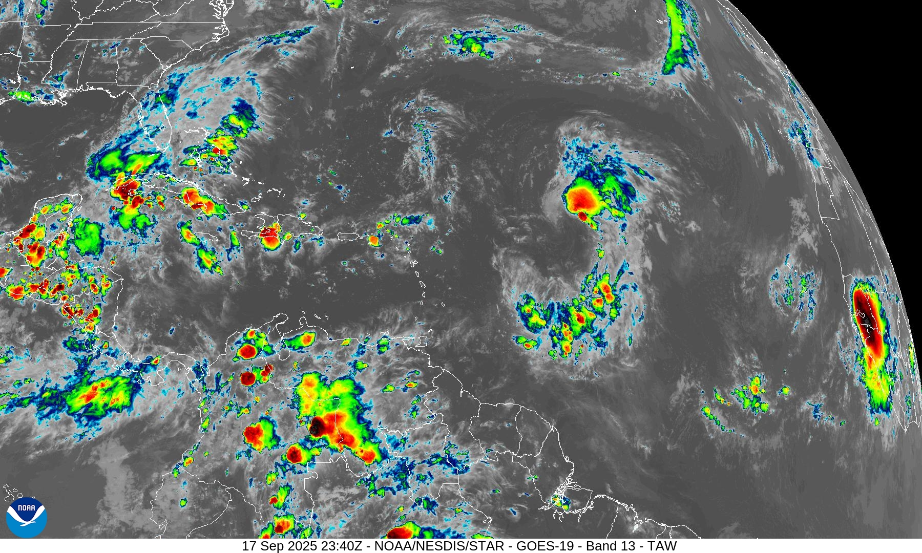
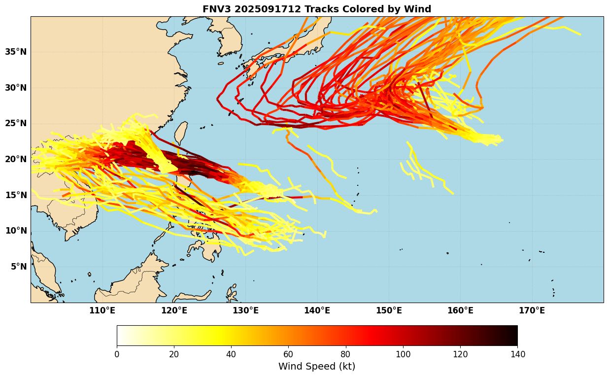
After a very quiet season to date, the West Pacific is waking up, with 23W the first of several systems that will be worth monitoring. Thankfully, this one should move into SE China without too much intensification. Two other systems could be more significant. Right now they are both “invests”: 90W East of the Philippines and 91W SE of Japan. AI models such as Google Deepmind (Figure 1) continue to indicate that 90W could get very strong and potentially become a Super Typhoon. The system could impact Luzon or the Babuyan Islands, and folks there should keep a very close eye on it. The system will also pass into the South China Sea after moving past the Philippines.
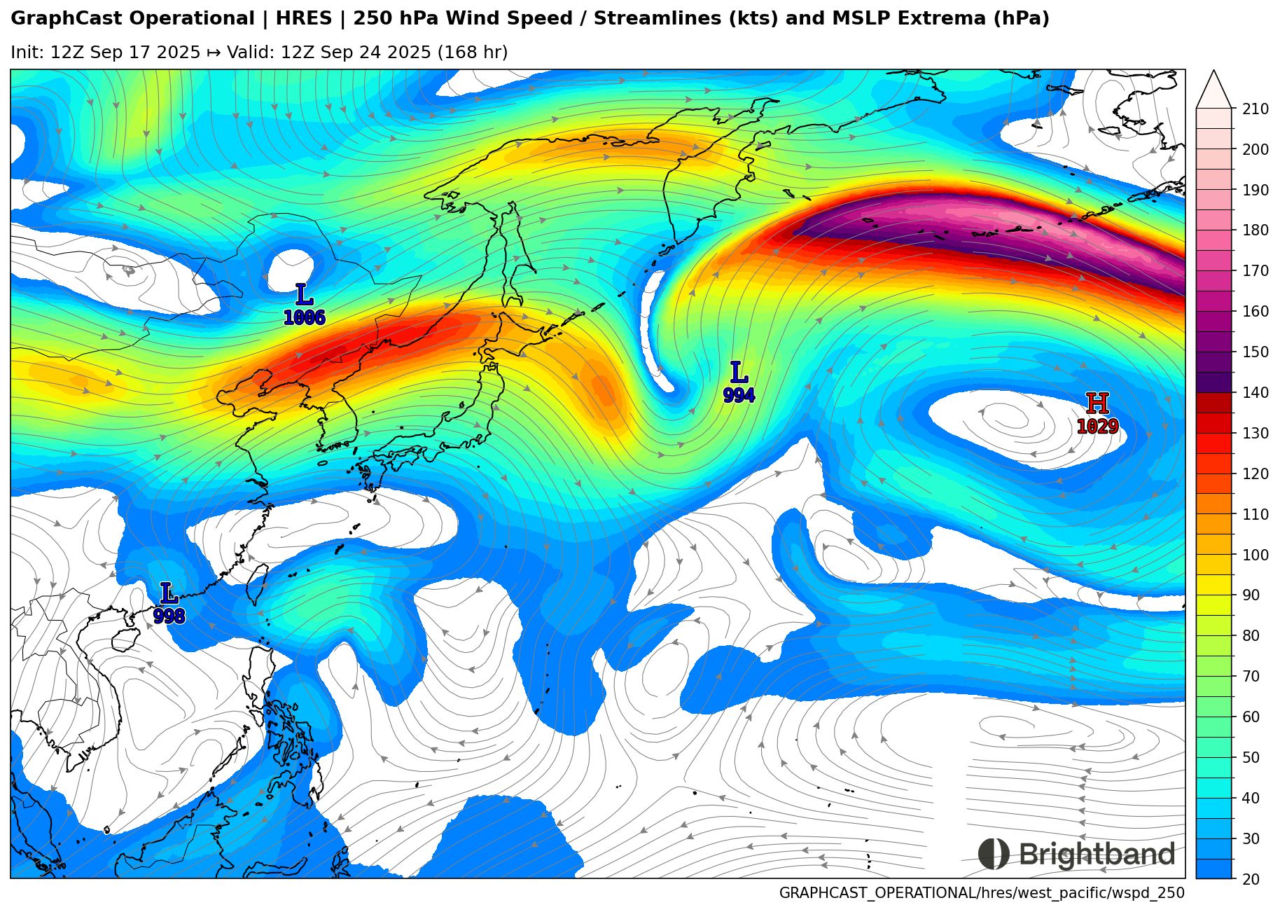
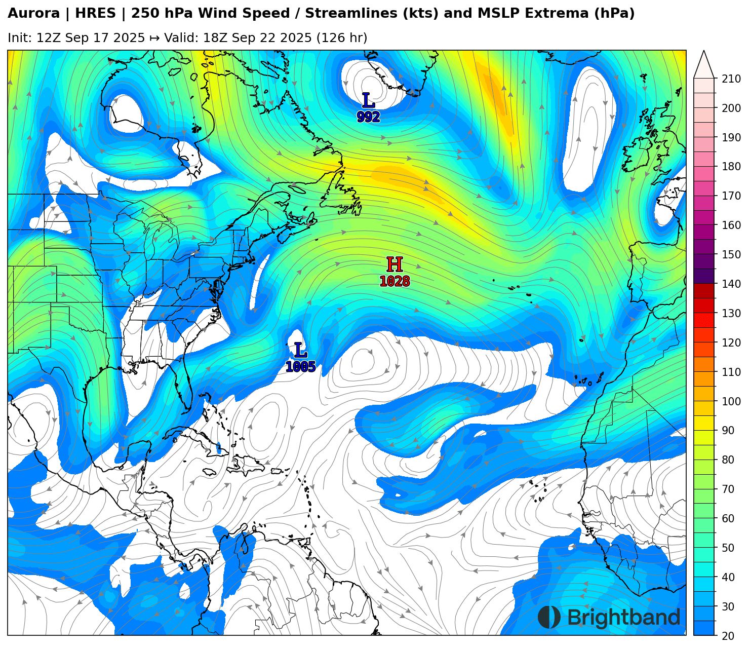
91W is a very interesting system because AI models (including AIFS) were the first to pick up on it, before physics-based models did (ECMWF is now showing development). There are some questions of how fast it will recurve, with large East-West spread. It should hopefully stay east of Japan, but it’s worth watching there. Another interesting aspect of this system is that it may interact strongly with the Pacific Jet as it recurves (Figure 2). If so, it could excite a Rossby Wave Train and decrease downstream predictability over North America in the Week 2 range. I’ll be interested to see how well AI-based models handle this process, since it’s something that involves a lot of heat release (which AI models don’t calculate explicitly). Something to watch in the coming days.
East Pacific
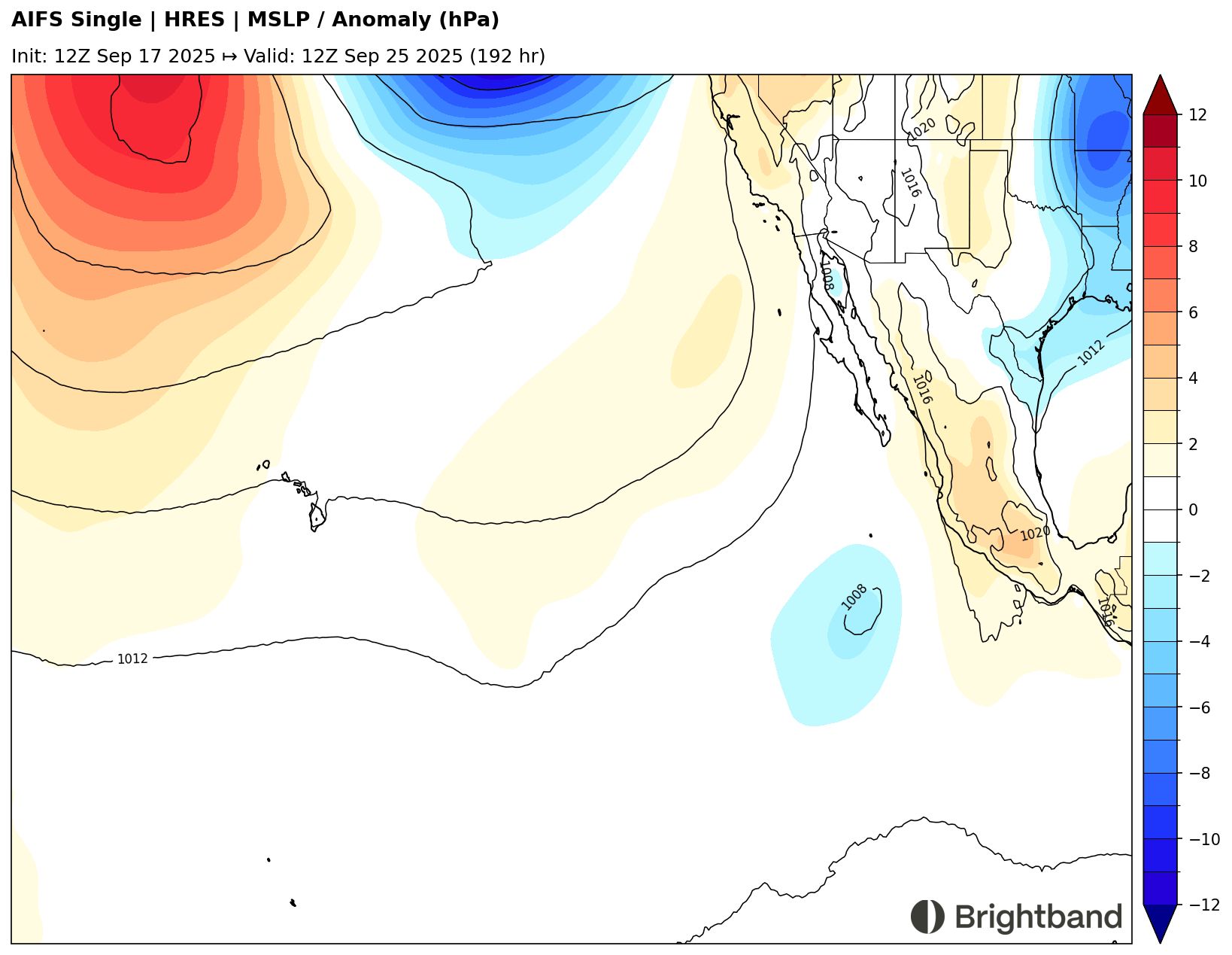
Tropical Storm Mario has dissipated, so there are currently no active storms over the East Pacific, but we do have Invest 96E. It is moving off to the west/northwest, and may develop into a TS briefly before moving into a more hostile environment over the weekend, over cooler water and surrounded by dry air (Figure 3).
After this, models have another potential system developing in the medium range in the same area (Figure 4), but it’s a little early to say whether it will follow the trend of tracking to the northwest and dissipating, or be more of a threat to the coast. Sometimes as we get into fall, troughs dip further south and bring storms from the East Pacific up towards the Baja Peninsula or Western Mexico. This will be something to keep an eye on next week.
Atlantic
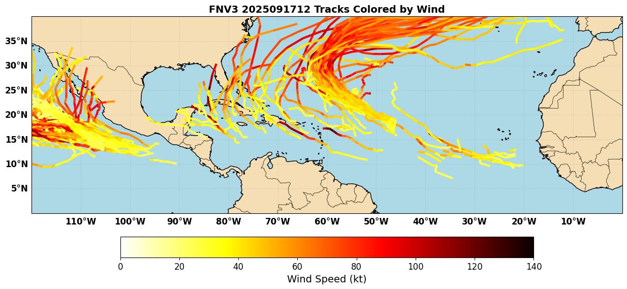
The Atlantic has finally awoken from a 3-week drought, with Tropical Storm Gabrielle named by NHC this morning over the Central Atlantic. The storm is currently very disorganized as it is tangled with an upper trough bringing dry air and shear over the system. However, it is likely to eventually intensify over the weekend or early next week as it starts to recurve near or just east of Bermuda. The storm could interact with the jet in a way that favors intensification as it accelerates off to the NE (Figure 5), although it will also be in southwest shear, so we’ll see how strong it can get.
Other than Gabrielle, NHC has marked two waves (one just moving off Africa and another getting ready to) for a low chance of development in the next 7 days. Ensembles suggest that the western one (currently near the Cabo Verde Islands) might be worth watching in the NW Caribbean or Southwest Atlantic down the road (Figure 6), but I have noticed that the AI models seem to be a little aggressive with TC genesis in this “fantasy range”. We’ll see - plenty of time to watch these waves over the next week.