Tropics Staying Busy in Early October: A Look at the Global Tropics 10-1-2025
After taking a look at the AI model performance for Ragasa last week, today we’ll head back into the forecast realm and see what AI models are showing for tropical systems across the Northern Hemisphere in the coming days.
West Pacific
The West Pacific has cooled off a little bit after the strong typhoons of the last 2 weeks, but it appears things will ramp up again soon. TD 27W has formed East of the Philippines, and it appears that it will take a track similar to Ragasa in between the Philippines and Taiwan and into the South China Sea.
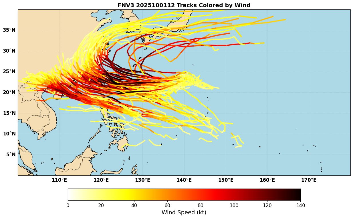
27W should have a chance to intensify, although it appears that most ensemble members right now are keeping it below Super Typhoon intensity, since it may not have a lot of time over water in the South China Sea, and could also be limited by some easterly shear (Figure 2). Still, it could pose a threat for flooding and other impacts in Southeast China near where Ragasa impacted recently, and so is worth monitoring. In the medium range, models are suggesting another potentially strong system could form East of Taiwan and move towards the west, so this will be something to keep an eye on in the coming days.
East Pacific
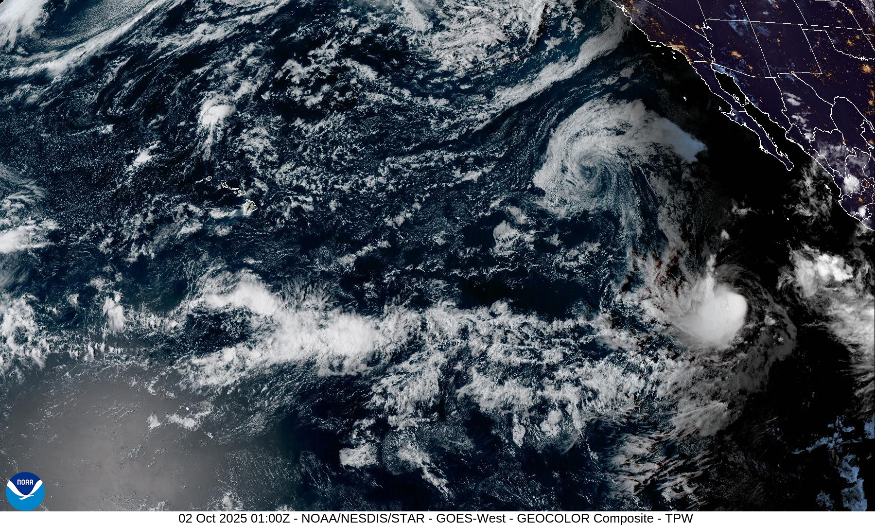
The East Pacific is also fairly active right now, with TS Octave having formed West of Mexico. This system looks to recurve harmlessly without intensifying much (Figure 3). DeepMind (and other models) suggest that another system is likely to form and parallel the coast of Mexico in the coming days. This system could get stronger and become a hurricane.
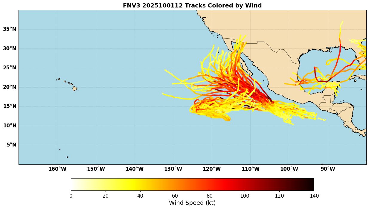
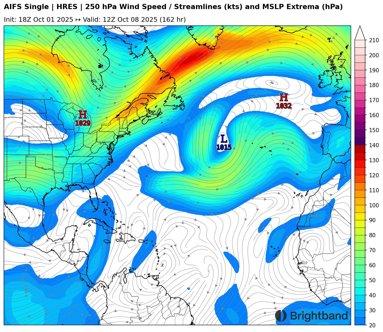
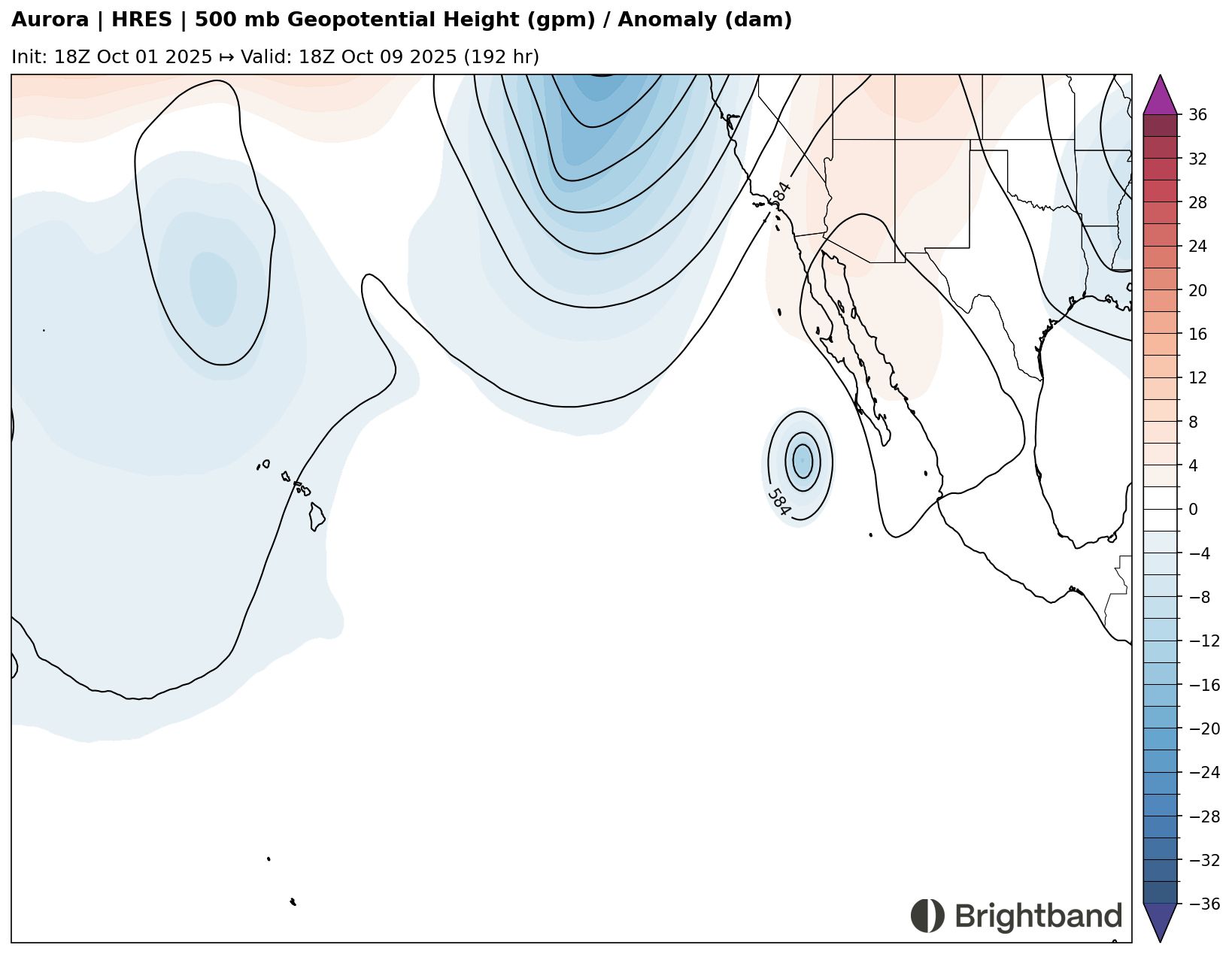
Medium range forecasts suggest that this later system could potentially be a threat to recurve towards Baja California, thanks to a -PNA pattern with troughing over the Western part of North America (Figure 4). It is not uncommon for systems in the East Pacific this time of year to turn northeast and threaten Mexico (think about storms like Patricia 2015 and Willa 2018) as troughs get deeper and further south with autumn becoming established, so that will be a trend to monitor.
Atlantic
With Humberto becoming extratropical and Imelda joining it soon (after a potentially nasty impact on Bermuda), the Atlantic will likely go quiet for the rest of the week. However, models are suggesting the break may not be very long-lasting. A wave moving off Africa could develop as it moves towards or north of the Lesser Antilles later next week (Figure 5).
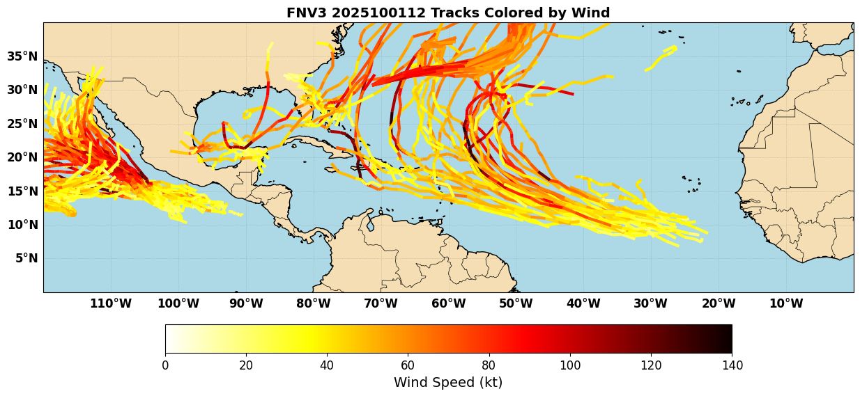
It’s a little too early to tell how far west this might get, or how strong it will be. Upper level winds look favorable over the Central Atlantic, with a large anticyclone overhead (Figure 6). However, with the ongoing East Pacific activity and a large anticyclone near Mexico, there could be some downstream troughing and upper shear near the Lesser Antilles that could be an obstacle for development. The ensemble shows a lot of spread in track and intensity, but it’s worth starting to keep an eye on this in the islands.