
Atlantic and Pacific Model Forecast Discussion 9-12-2025
For today’s tropical forecast discussion (with an emphasis on AI models) we will go around the world, from west to east.
West Pacific
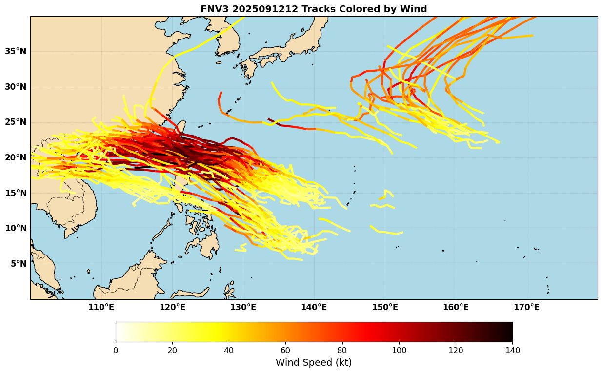
The West Pacific has been remarkably quiet, with no 100-knot typhoons so far and Accumulated Cyclone Energy (ACE) well below average. There are some indications, however, that this will change soon, with some models starting to pick up on the possibility of a strong typhoon forming in the monsoon trough in about a week and bending west towards Taiwan, the Philippines, or between the two (Figure 1). This will be worth keeping an eye on heading into next week to see how it comes together.
East Pacific
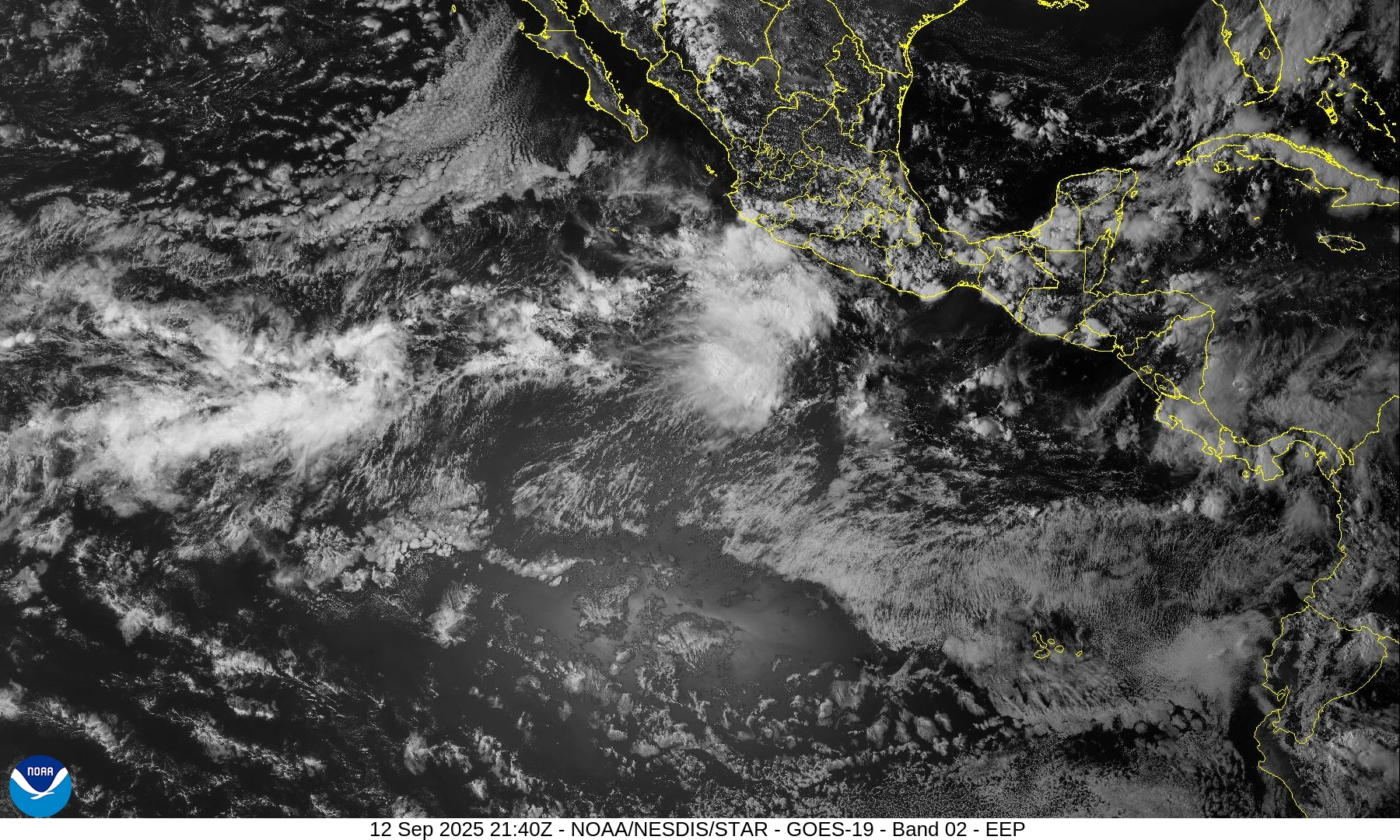
The East Pacific is still active, with newly-named Tropical Storm Mario south of Mexico today. The storm is currently in an area of NE shear, but as it moves to the Northwest this weekend, it will move under the upper level anticyclone (Figure 2). This should give it a window to intensify as long as it stays offshore of Mexico. It could even reach hurricane status before it moves into a more hostile environment next week, with dry air and cooler waters west of Baja California.
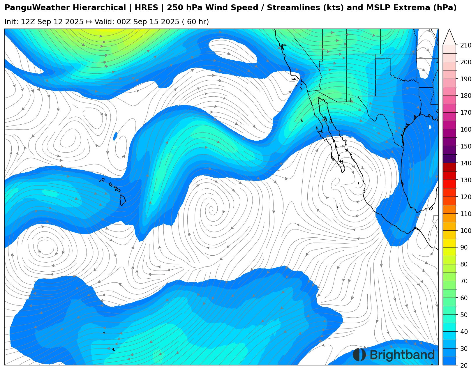
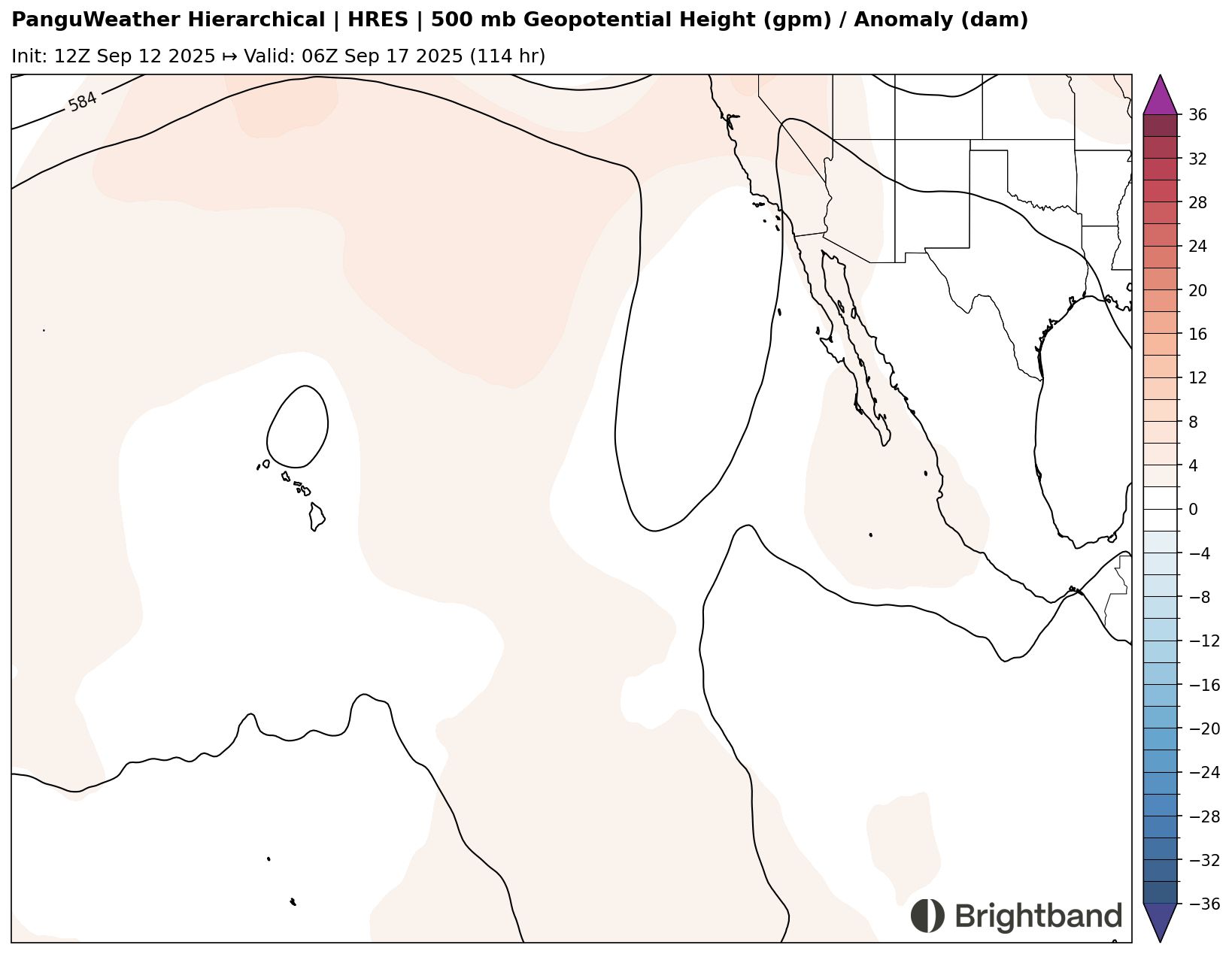
Ridging looks to stay strong enough to keep the system on a west-northwest heading (Figure 3), so it should stay offshore of the Baja Peninsula and eventually dissipate over the cooler waters.
Atlantic
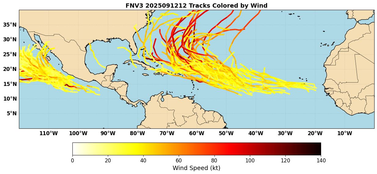
The Atlantic is still holding in an overall quiet pattern despite being at peak season. There are some slight indications things may try to pick up soon. Models are showing signs of development from a wave moving off of Africa, and another one set to emerge in a few days. The Google Deepmind FNV3 ensemble illustrates this, with a variety of tracks emerging from the MDR and recurving into the SW Atlantic (Figure 4).
There is a lot of uncertainty as to what, if anything will develop from these waves. Several obstacles exist:
- The Atlantic background stability is still fairly hostile.
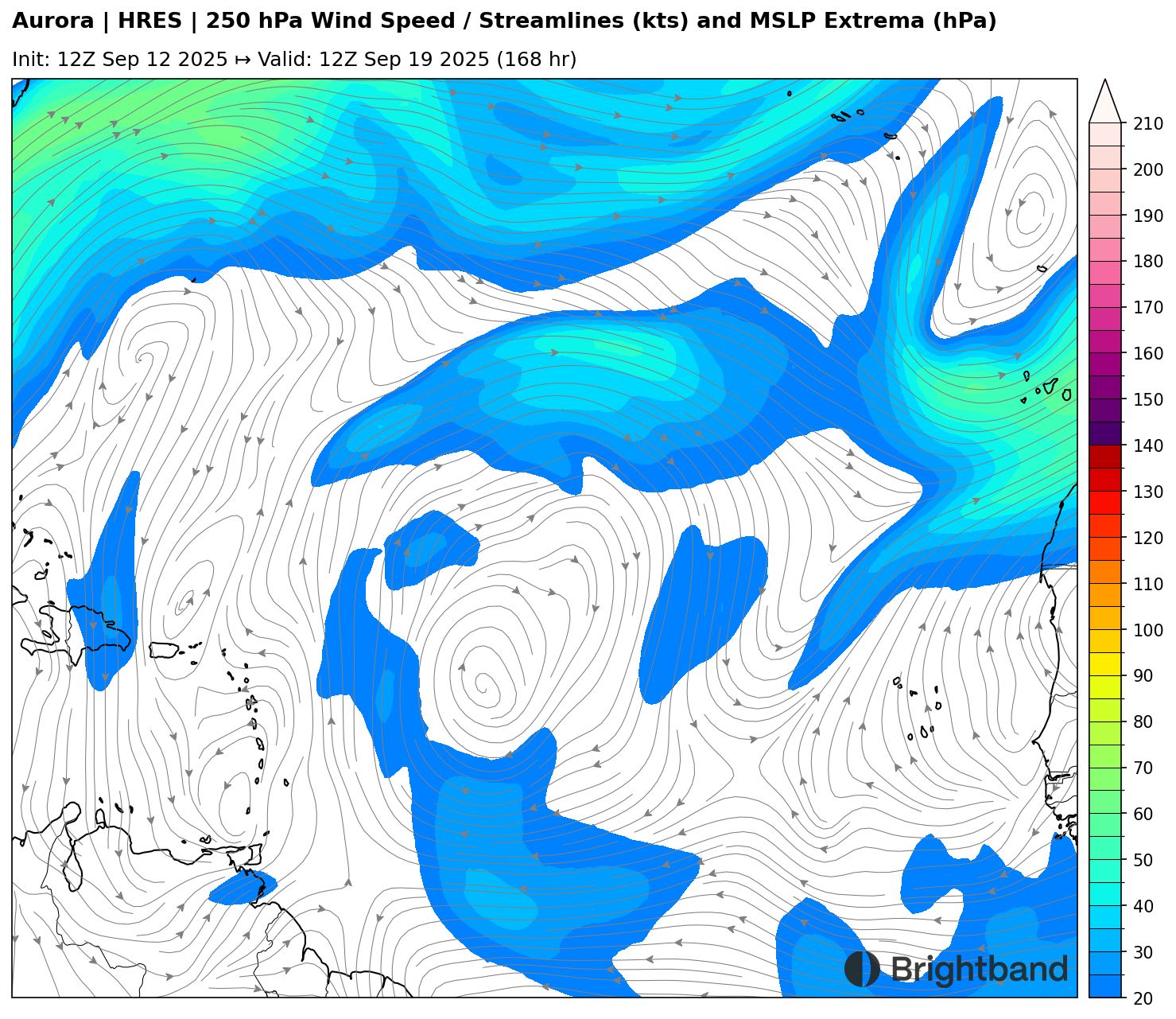
- While shear is low in the MDR, shear is high along 20N, and TUTTs dipping down towards the MDR (Figure 5) will bring shear and dry air into the path of these systems, and also potentially string them out to the north.
- If the waves are not spaced sufficiently, they may interfere and interact with each other.
The MJO is starting to move into the basin next week, and so large-scale subsidence may start to lessen. This could allow for some development, but it remains to be seen. We’ll check back in next week, hopefully with a better idea of what these waves are going to do.