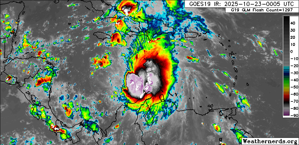
Melissa Threatens the Caribbean: AI Models Discussion 10-22-2025
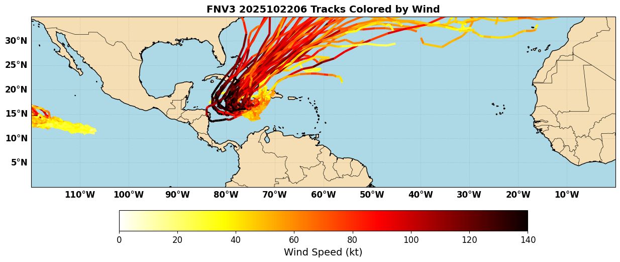
Tropical Storm Melissa formed in the Caribbean yesterday. Currently the storm is moving very slowly north of South America. It should start to turn NW today, but there is still a lot of track uncertainty in the medium range. This is illustrated in the Google Deepmind/FNV3 ensemble (Figure 1), which still has a variety of tracks: some towards Hispaniola and some turning west near or South of Jamaica and spending more time over the Caribbean.
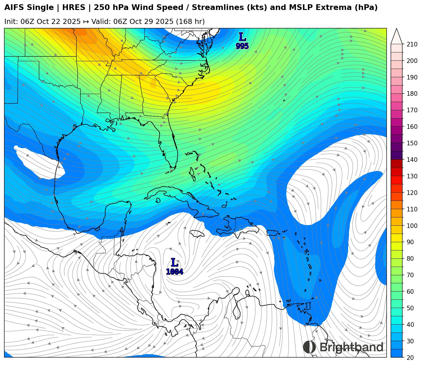
One interesting thing to note is that almost all of the members that turn west with the system and take it south of Jamaica turn Melissa into a Category 4-5 storm. The upper-level environment looks extremely favorable if the system does head west for a time, with light anticyclonic winds allowing the TC’s outflow to expand in all directions (Figure 2).
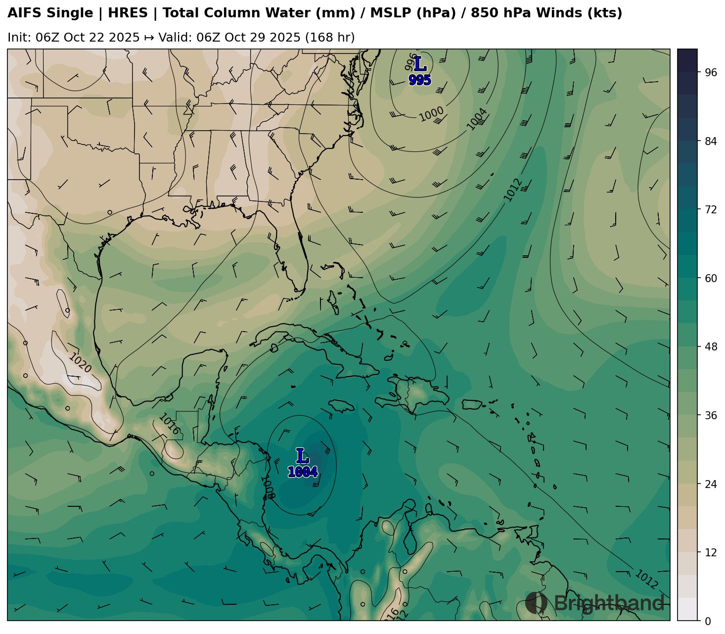
In addition, the Caribbean is warmer than average across the board, and environmental moisture is also very high (Figure 3). This means that, from a large-scale perspective, all the ingredients are in place for a storm to intensify quickly if the structure supports it.
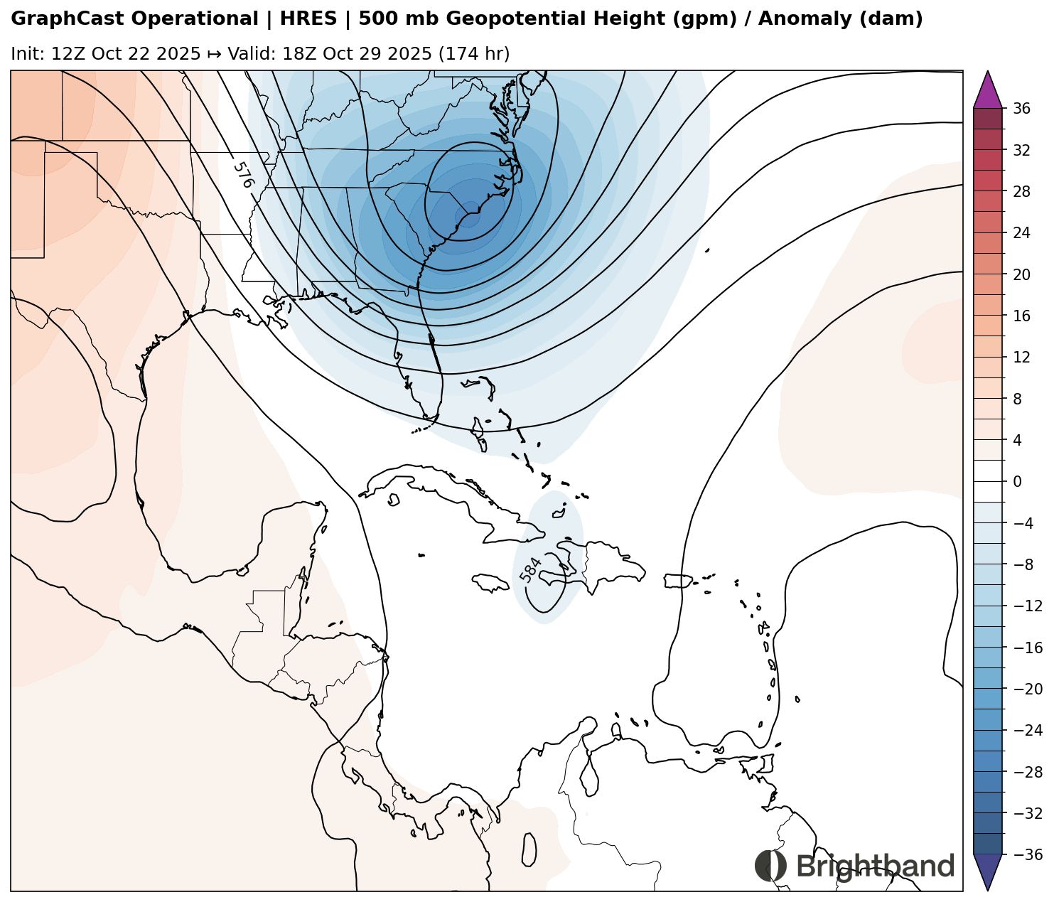
The track forecast has started to narrow a little bit. Fewer models now take the storm towards Hispaniola, and more of them show a westward track south of Jamaica and towards the NW Caribbean. There are still some discrepancies, however, with some models showing a stall near Jamaica and turning towards the NE. This seems to be due to differences in a trough over the East Coast of the US in about 6-7 days. For example, GraphCast shows Melissa getting pulled NE across the Windward Passage and tip of Haiti ahead of this trough (Figure 4).
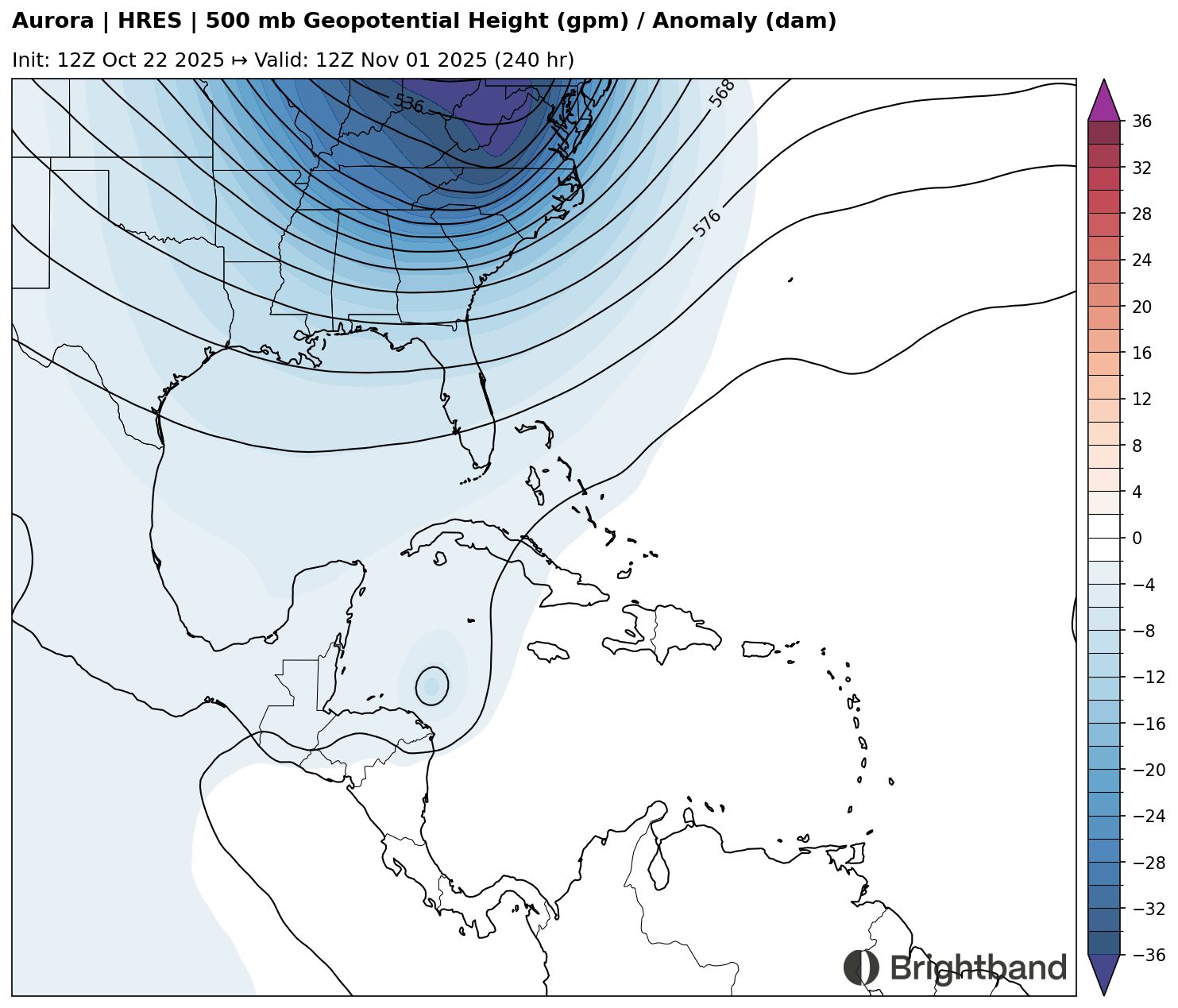
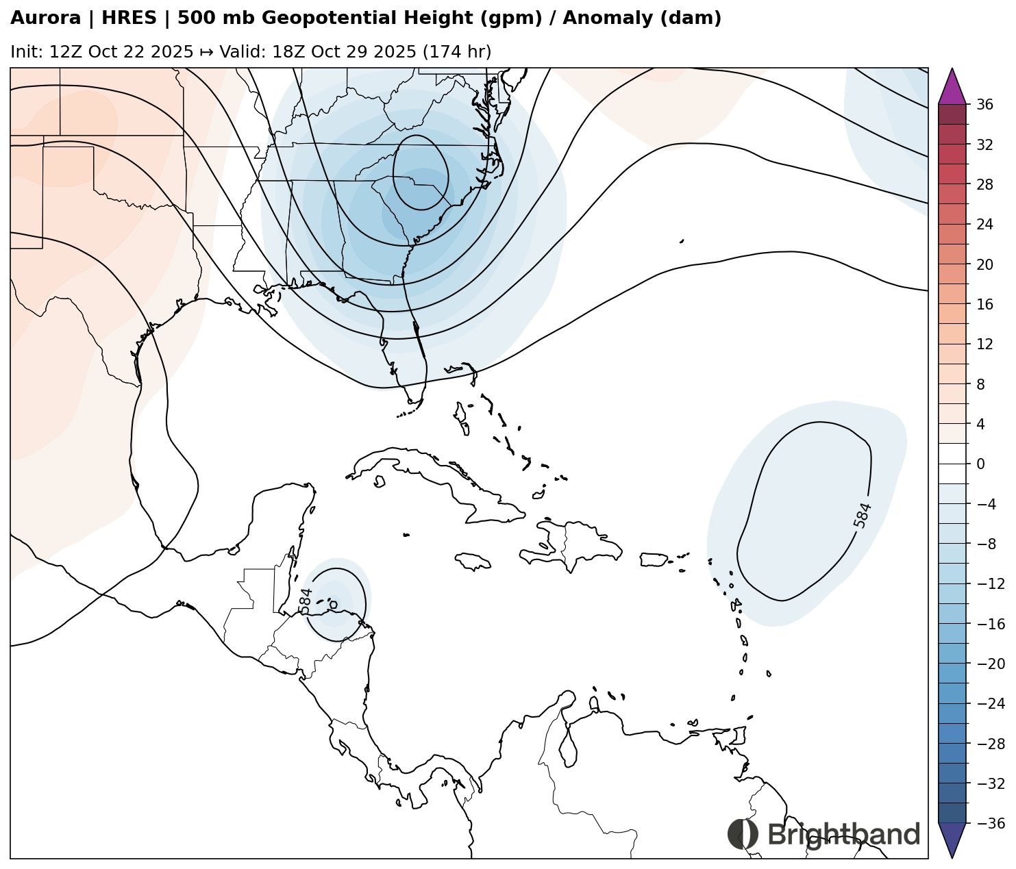
In contrast, Aurora has the storm further west initially, and a weaker trough (Figure 5), so the storm misses the immediate NE turn and continues NW for a while.
Looking into the medium range, the location of the system and the depth/timing of the trough that will finally pull it out of the Caribbean could become important for the final track outcome, and whether it has any chance of getting close to the Continental US. Right now the trough looks too broad to hook the system N/NW, and it looks like it should accelerate NE. We’ll see if that changes at all as things progress throughout the week.
It’s still too early to tell exactly where Melissa will hit and how strong it will be, but folks all through Cuba, Jamaica, the Dominican Republic, Haiti, and the Cayman Islands should keep a close eye on the forecast and be ready to take action if needed.