Global Tropics Discussion 10-15-2025
We’re back today with a global tropics tour, to see what AI models are indicating for a few potential systems.
Indian Ocean
We haven’t discussed this basin much this year, but models are starting to indicate the possibility of an interesting occurrence of several simultaneous TCs in the Indian Ocean late next week. GraphCast actually indicates the possibility for up to 5 simultaneous lows, 3 in the Northern Hemisphere and 2 in the Southern Hemisphere (Figure 1).
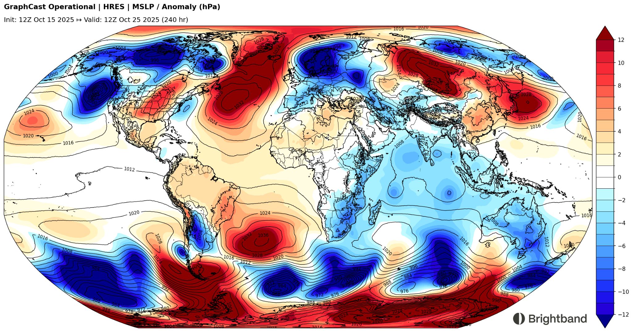
This pattern will arise thanks to a strong pulse of the Madden-Julian Oscillation (MJO) moving through, with a low-level “westerly wind burst” that will increase vorticity on both sides of the equator, as well as enhance convection over the area. It’s not unheard of to get twin TCs on either side of the equator during these transition seasons, and we’ll see how this pattern evolves as we get a little closer in time.
West Pacific
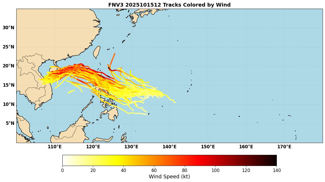
is moving off to the West, and forecast to become a TC over the next couple of days. GFS and other models have come into agreement with AI models on a general track towards Luzon over the next few days. There is still some north-south spread, with more latitude gain on stronger ensemble members (Figure 2), which is fairly common.
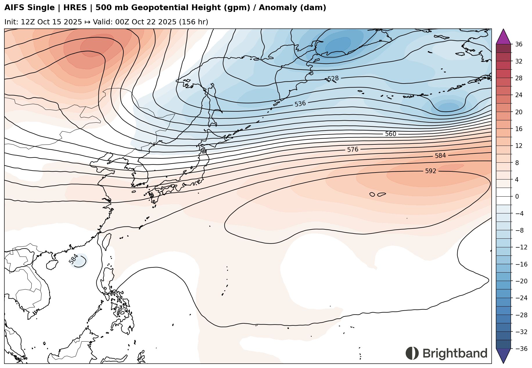
After crossing the Philippines, the system is likely to turn WSW thanks to a strong ridge building to the north near Southern China (Figure 3). The sharpness of this turn and where it starts will probably determine the degree of threat to Hainan and eventually the coast of Vietnam, but that’s a little far out to have much confidence.
East Pacific
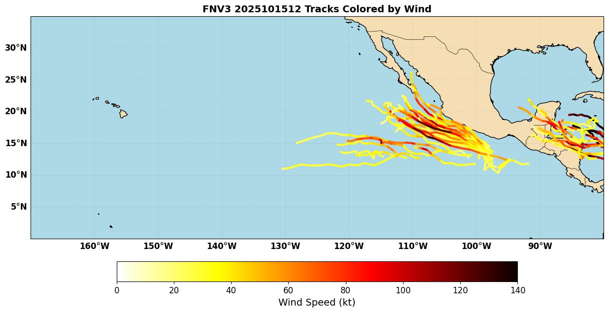
Invest 91E has been tagged south of Mexico and is currently given a 60% chance of developing within the next 7 days by the National Hurricane Center. Small systems south of Mexico have proved challenging for models recently, so it’ll be interesting to watch how this evolves. Currently, AI models are indicating the possibility of intensification. Compared to earlier, fewer FNV3 members turn towards Mexico, which is a positive. We’ll see if that holds as we head later into the week.
Atlantic
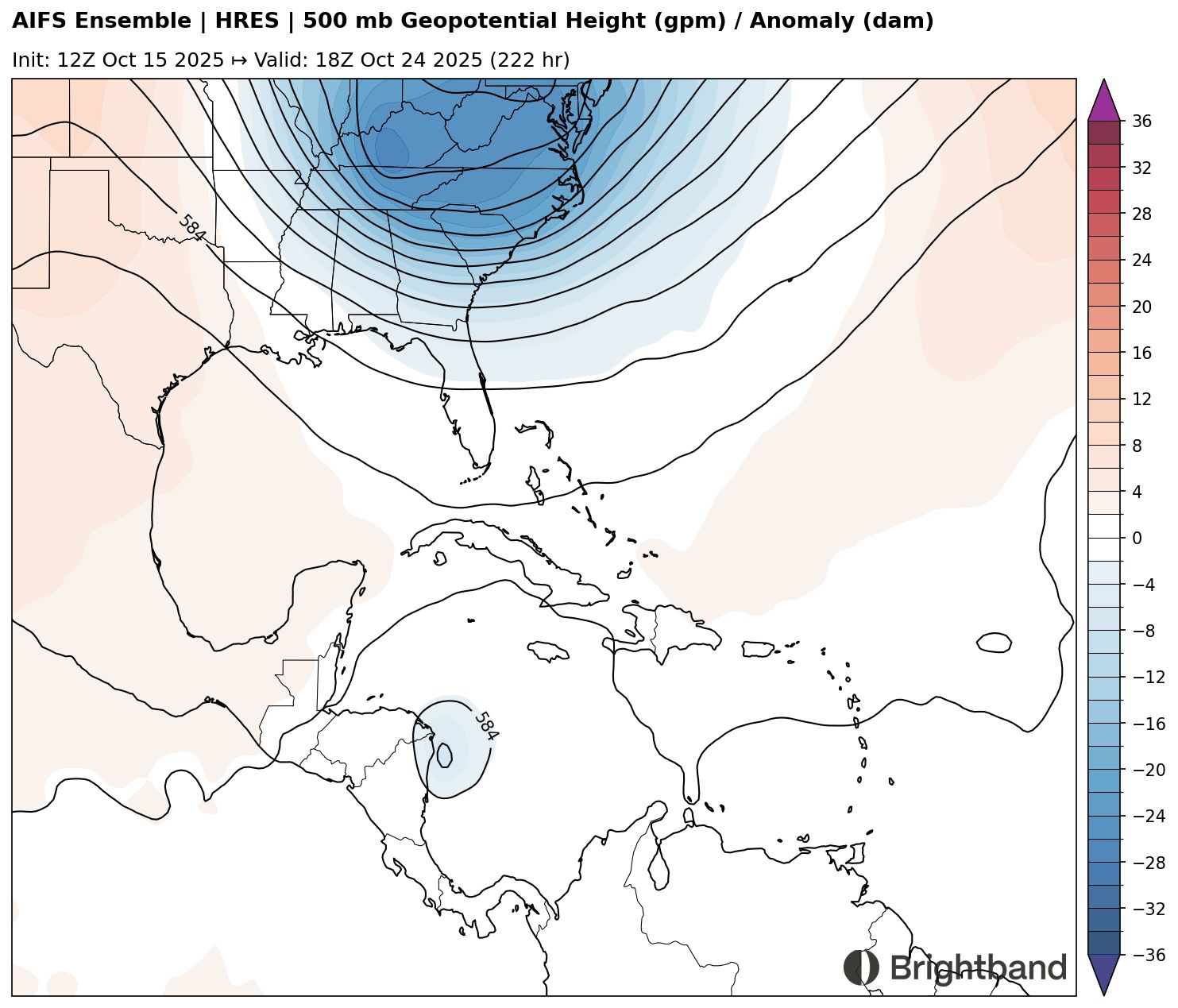
Tropical Storm Lorenzo is still around, but is not very organized and will probably fall apart and dissipate in dry air soon. The main candidate for development after this will be a tropical wave currently out in the Central Atlantic, as it moves towards the Caribbean next week. Some AI models (in particular the Google FNV3 ensemble, Figure 5) are starting to indicate that a TC may develop there in 7-8 days as the wave interacts with the monsoon trough.
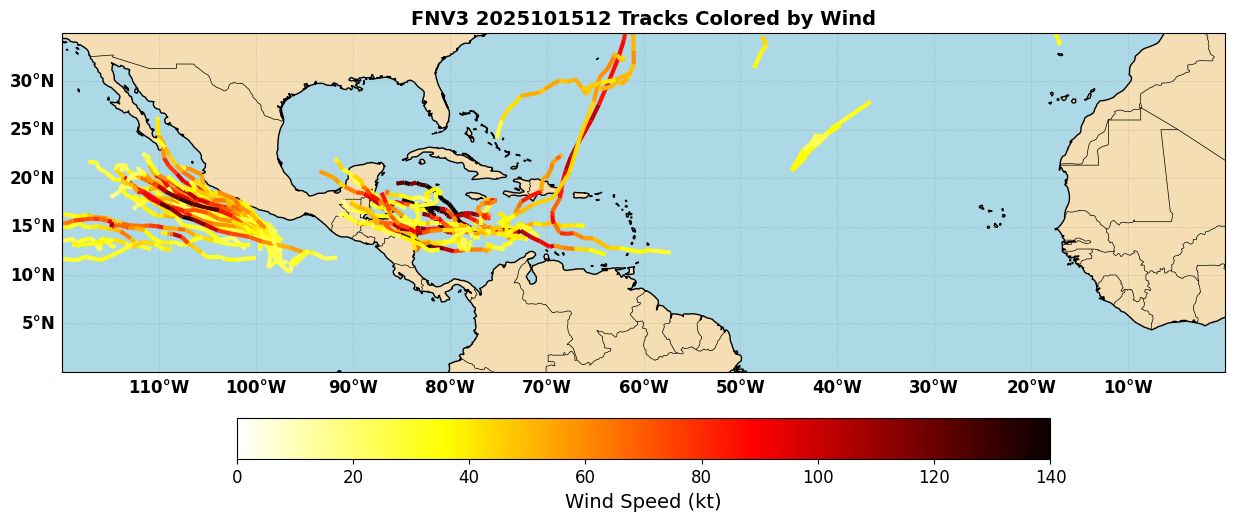
Overall, though, AI models are still generally less enthusiastic about development than the dynamical models. Some of this may be due to steering. AIFS, for example, seems to have a strong ridge nosing in over the Northwest Caribbean, which shoves the system into Nicaragua before it has time to develop significantly (Figure 6). The AIFS TC is fairly weak/shallow, however. A deeper system might feel the weakness in the ridge to the northeast and slow down as the trough to the north moves east, potentially tugging the system into the Northwest Caribbean. Due to uncertainties in TC formation and timing (if one does form), as well as uncertainties in the synoptic pattern, ensembles have a huge spread, from dissipation over Honduras to a quick turn across the Antilles to a track into towards the Yucatan, with a large number of possible intensities as well.