Global Tropics Discussion 10-13-2025
After taking a deep dive into the performance of AI forecast models for Hurricanes Humberto and Imelda in the Atlantic, today we’ll go back to looking at some live data to examine current and future candidates for development across the global tropics.
West Pacific
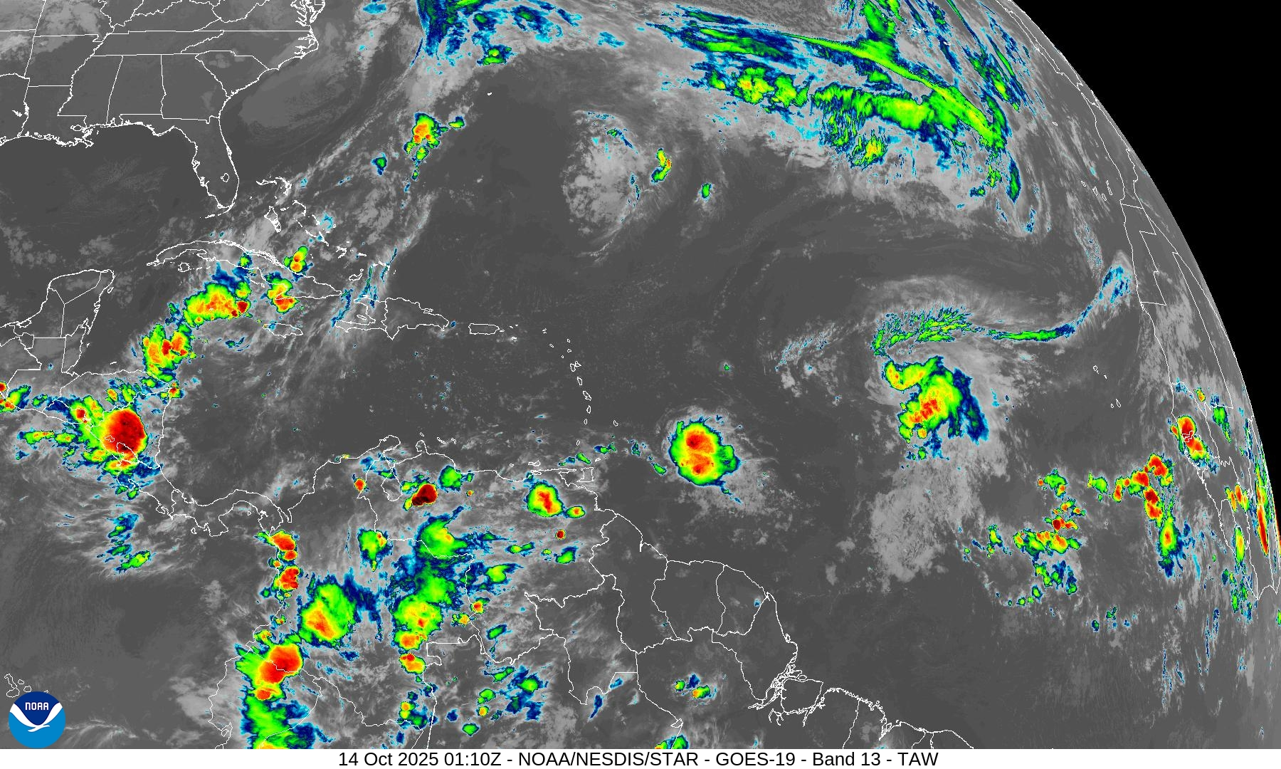
Typhoon Nakri is recurving and weakening to the southeast of Japan. In its wake, models are suggesting that another system may form to the East of the Philippines and track west (Figure 1). This has been a common genesis location and path so far this season.
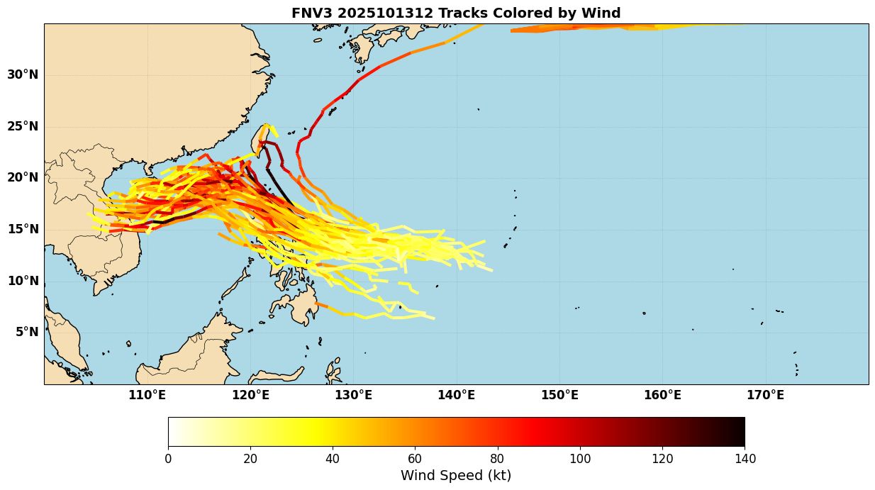
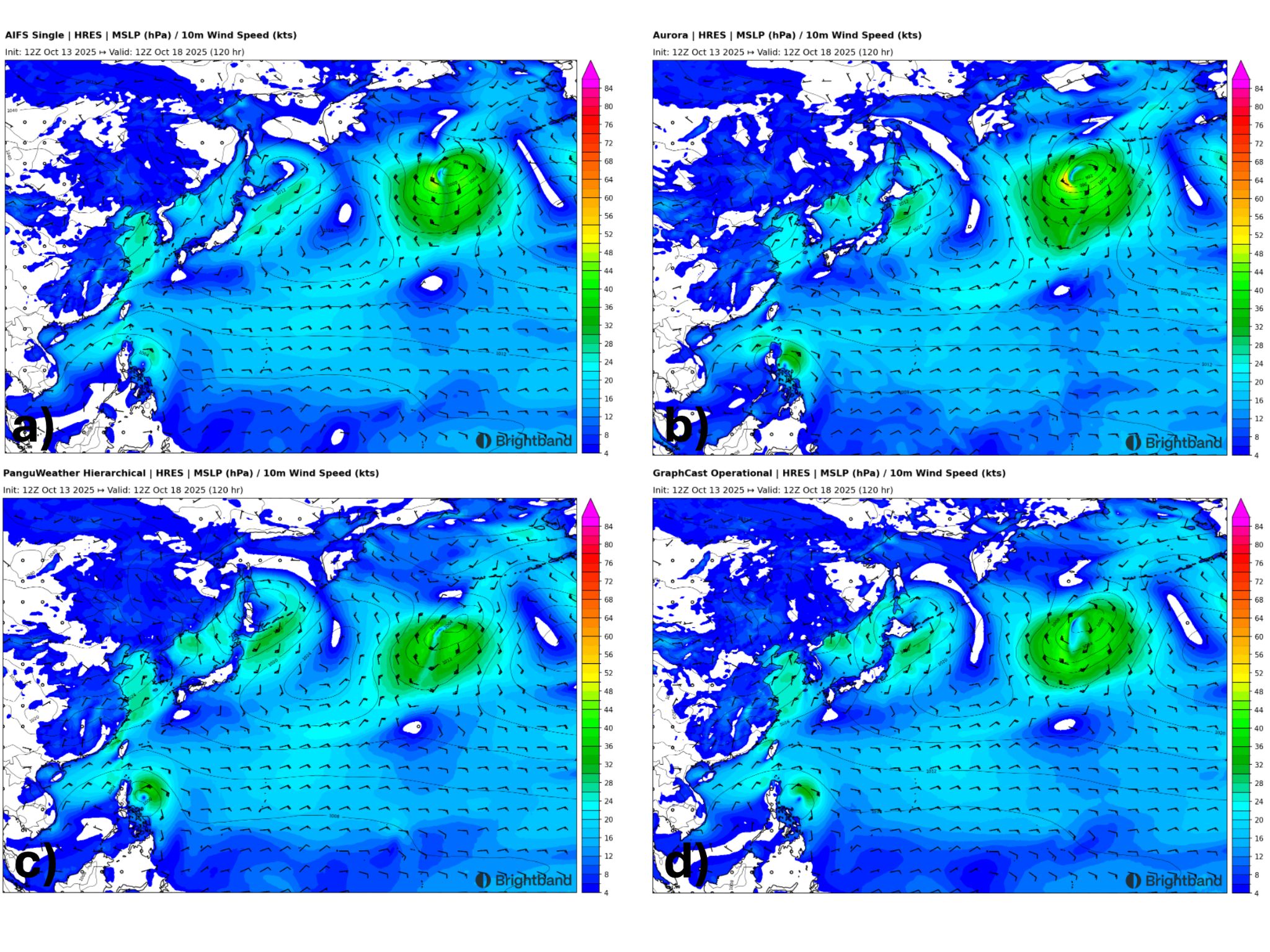
Currently, most AI models track the system towards the Philippines. Figure 2 shows AIFS, Aurora, PanguWeather, and Graphcast 5-day forecasts, and also show the system just east of Luzon. We will need to watch for the possibility of some rapid intensification prior to landfall, although currently FNV3 and most models deepen more after crossing the Philippines into the South China Sea.
East Pacific
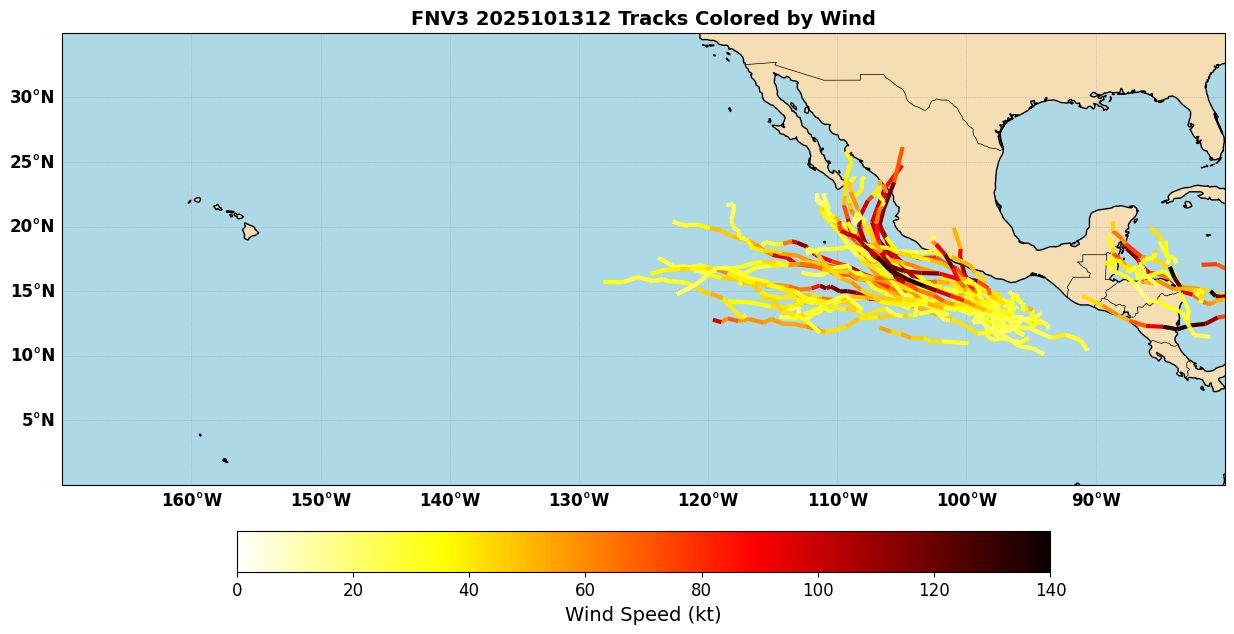
The East Pacific has quieted down some after a run of activity, but models indicate that there could be another system to watch soon. An area of low pressure is forecast to form South of Mexico, and then potentially develop as it tracks off to the west. Some ensemble members take it west and die out over cooler waters, while others bring the system back towards Mexico as a stronger storm (Figure 3). This is still a ways out, but it’s worth noting that dynamical models have struggled in this region at times (Hurricane Otis in 2023 and Hurricane John in 2024, for example). So it’ll be important to see how things evolve in that region in the coming days.
Atlantic
The Atlantic has a new tropical storm, Lorenzo, which formed out over the Central Atlantic and is moving to the northwest. It is currently battling some shear, and though the shear is forecast to decrease, dry air could also limit development. Some Deepmind/FNV3 members (Figure 4) do intensify the storm, but others keep it weak. It may take an unusual looping track as it starts to recurve and then turns back to the south. It may not stay as an actual TC this whole time, however.
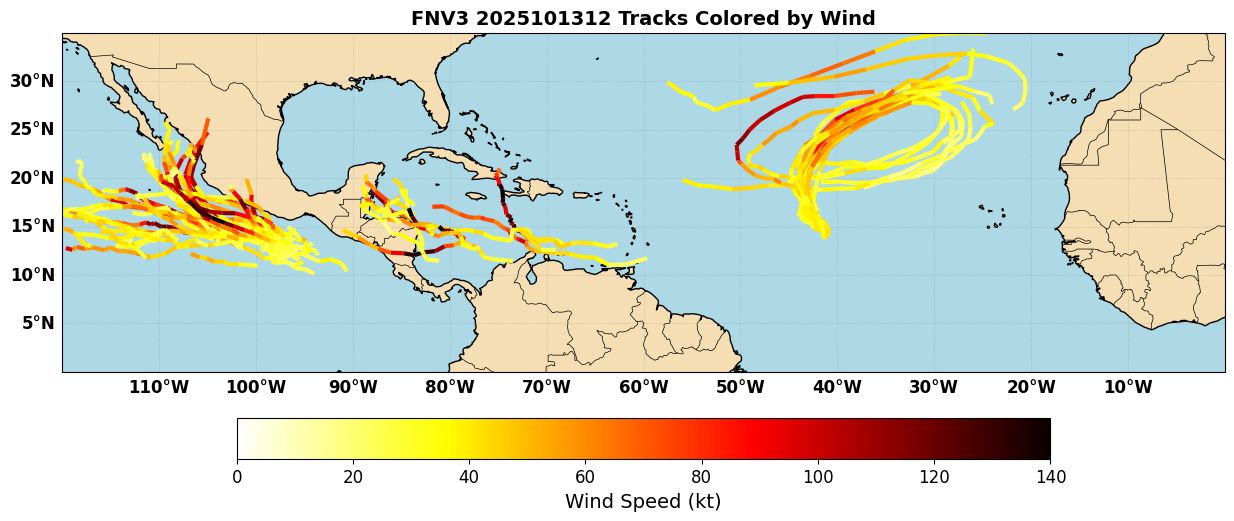
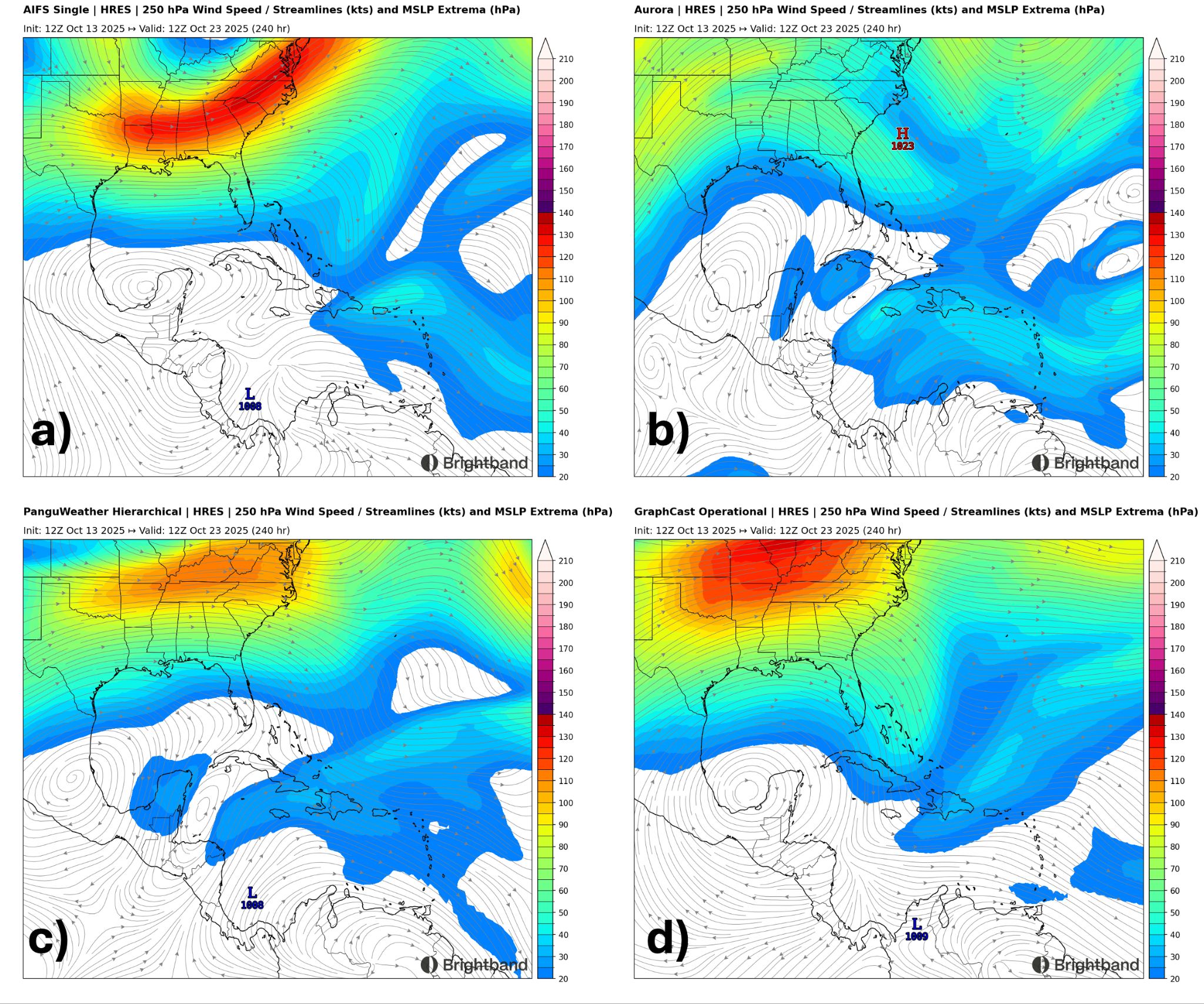
The other potential system of interest comes from a wave moving off Africa currently. Some global models (especially GFS) have been turning this into a strong hurricane in the Caribbean down the line. A few ensemble members show development there, but in general the AI models are much less enthusiastic about development. Most of them show just a weak wave/low tracking just north of South America with little development (Figure 5).
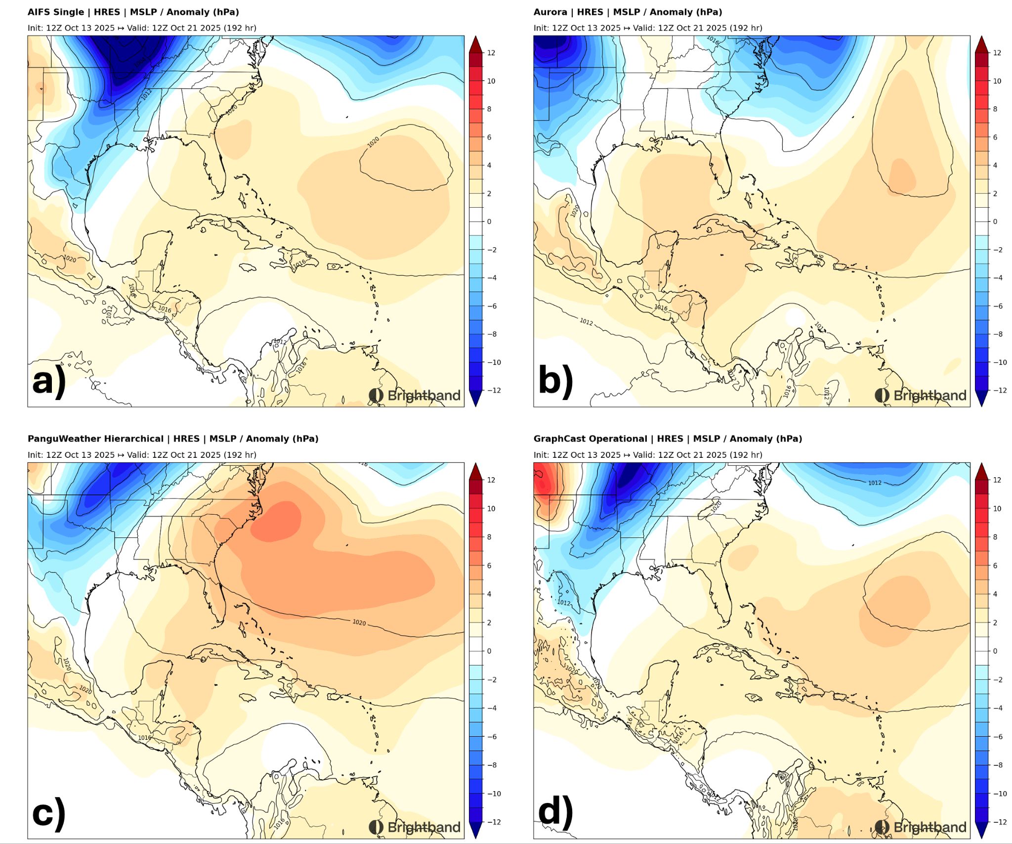
Most AI models indicate that a strong ridge of high pressure to the north will push the system into Central America with little to no development, but if something does get going, the upper pattern looks generally favorable for intensification, with light upper winds over the Central/Northwest Caribbean on most models (Figure 6). This is a good case to evaluate the AI models and see if their lack of development in the medium range proves correct compared to the more aggressive dynamical global guidance.