
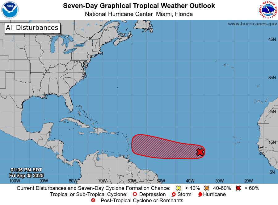
Discussion of Invest 91L
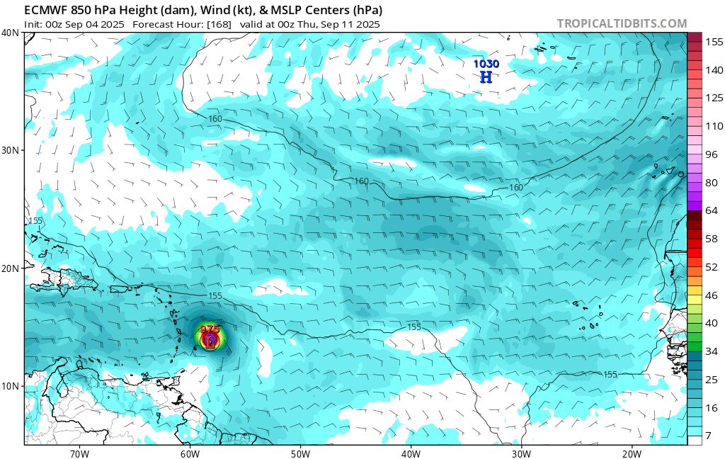
A system that has gotten a lot of attention the last few days is Invest 91L out over the Central Atlantic. It currently has a 90% chance of development from the National Hurricane Center. For several days, most global models were adamant about development of the system. 00Z ECMWF yesterday, for example, showed a hurricane forming and approaching the Leeward Islands about a week later (Figure 1).
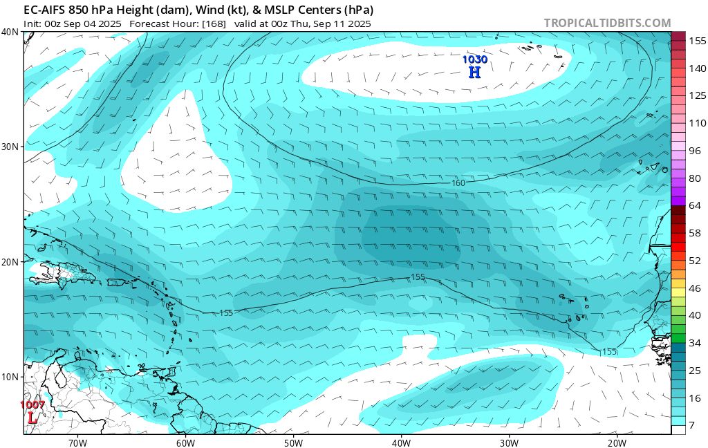
However, most AI-based guidance, especially the EC-AIFS and Google Deepmind, were less aggressive with development. EC-AIFS just showed a weak wave or trough axis moving towards the islands (Figure 2).
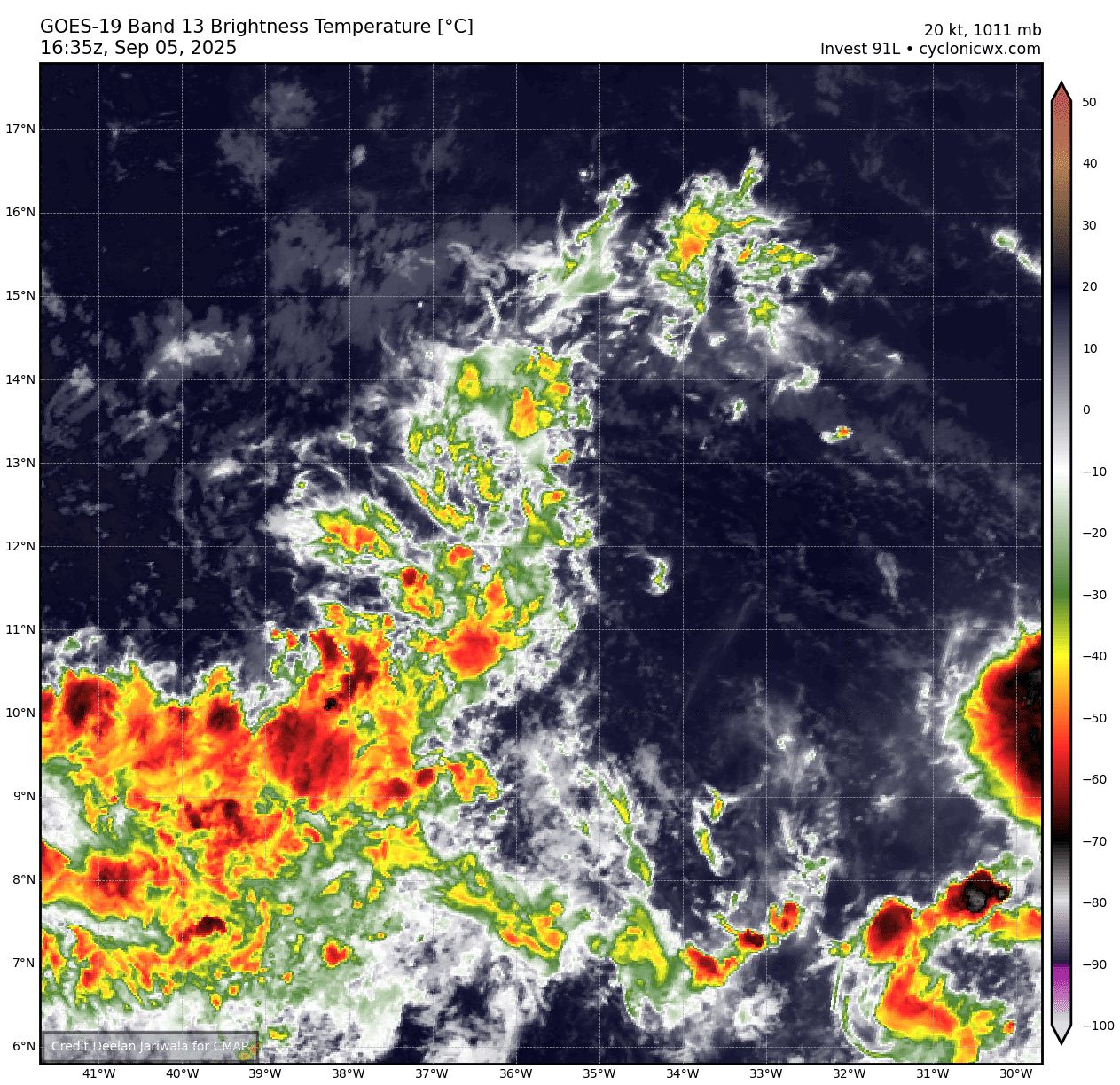
As of today, Friday September 5, almost all global models have dropped development of 91L. It is surrounded by dry air and has had a hard time generating convection (Figure 3).
The large-scale environment has been well-forecast, so I am curious about a few things:
- Why did AI models apparently correctly predict that 91L would not be able to form a coherent vortex? Was it just luck or something in the pattern that it “saw”?
- Are there other cases where AI-based models might incorrectly show no development? We can’t assume it’s always going to be right.
- The global models were showing a very small storm developing, which I am not sure we can expect AI models to reasonably pick up on. So was it perhaps right for the wrong reasons?
These questions are not something we can definitively answer right away. This would be an interesting avenue for research and a deeper dive. AI models have shown a lot of promise on track skill, and some with intensity (particularly Google’s new Deepmind system), but I haven’t seen much evaluation of TC genesis skill yet. That will be an important part of evaluating these models going forward.
We will take another look next week once 91L's fate is more certain, and also see what AI models are showing for the Atlantic as we get into the peak of the season.