Atlantic and Pacific Model Forecast Discussion 9-22-2025
We’ll take a global tour of the tropics, where things are staying pretty active this week across multiple basins.
West Pacific
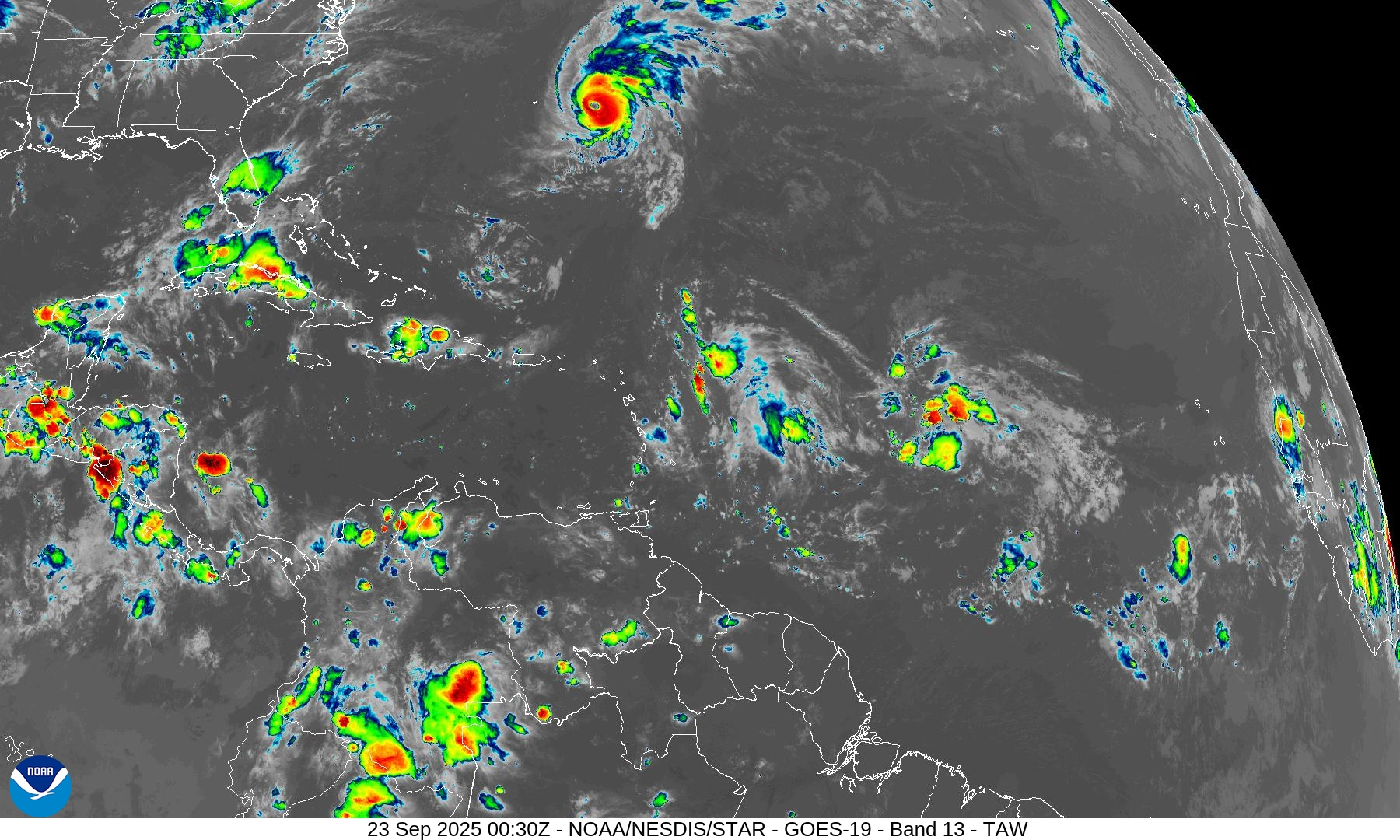
Supertyphoon Ragasa is the main feature of interest right now in the West Pacific. After a devastating impact on the Babuyan Islands, Ragasa is now moving towards the coast of Southern China. Although it is forecast to weaken as it moves onshore, it could bring a lot of storm surge, wind, and flooding rains to the coastline.
Behind this, AI models (such as Google Deepmind, Figure 1) are showing the potential for another system to develop and potentially impact the Phillipines, although early indications are that it should be weaker than Ragasa. It will be worth watching this system and any others behind it as this active period continues in the West Pacific.
East Pacific
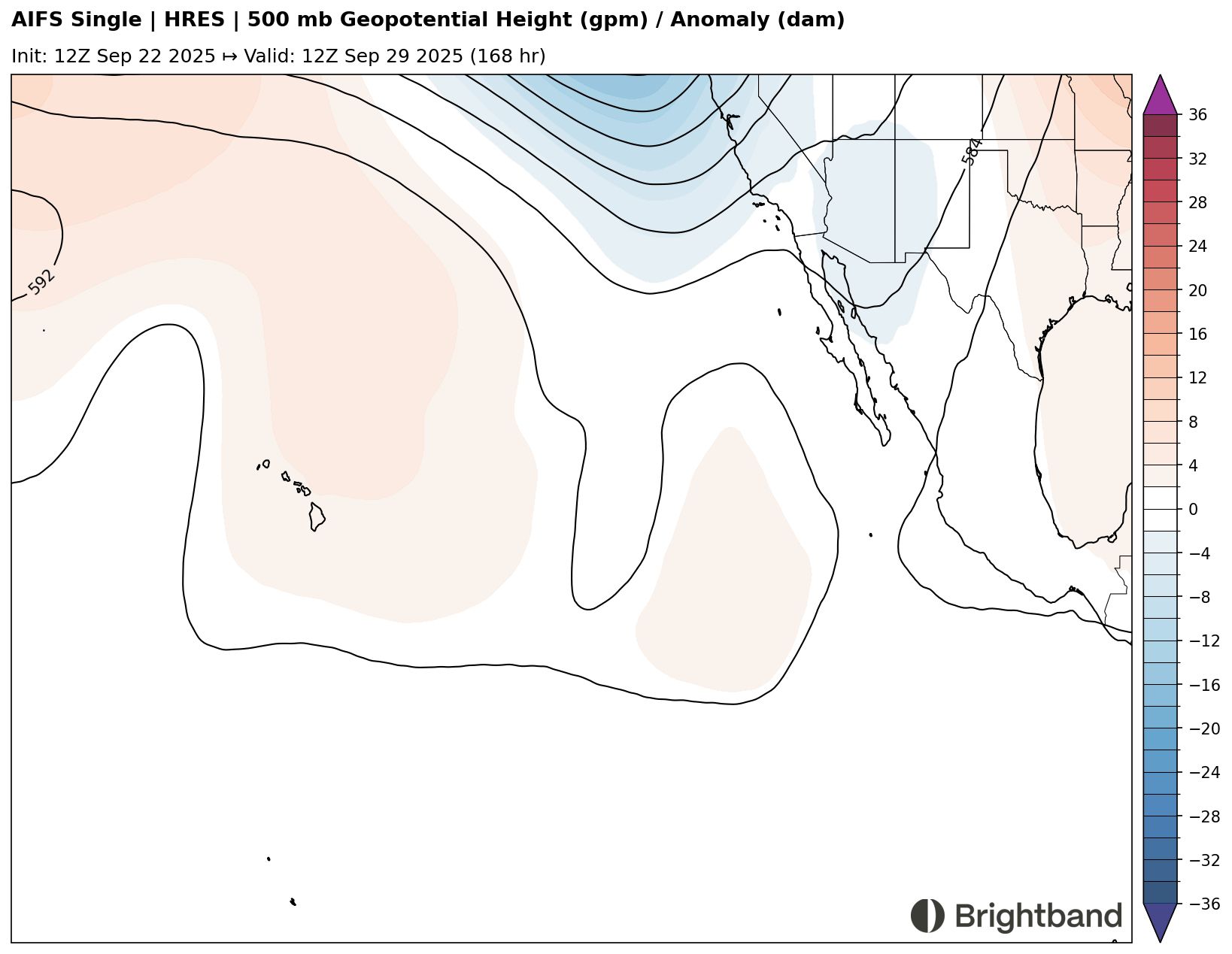
Tropical Storm Narda is the main feature of interest in the East Pacific over the next few days. It is starting to intensify, and models continue to indicate that it will intensify further in the coming days. The storm will move west under an upper level ridge with fairly light easterly upper level winds (Figure 2), so that should favor continued intensification.
Later on, the ridge is forecast to weaken as an upper trough dips down, and so the system will likely be pulled to the north and weaken well before approaching Hawaii (Figure 3).
Atlantic
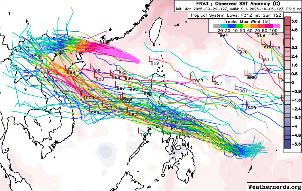
Last week we discussed how AI models were starting to pick up on two waves over the Central Atlantic, even though other models were not onboard. Over the last few days, the physics-based models have started to come around to the idea that the AI models were depicting of one or both of these waves developing into a tropical cyclone. AI-based models like Google Deepmind (Figure 4) and AIFS continue to be fairly aggressive with development as well.
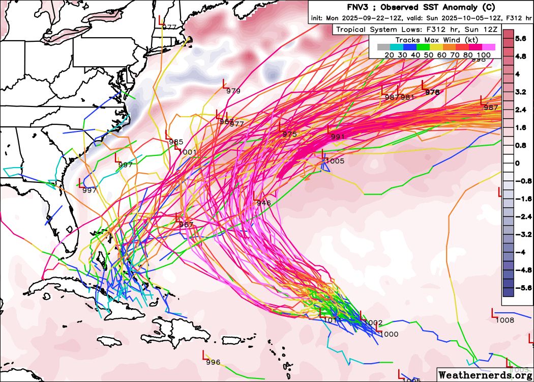
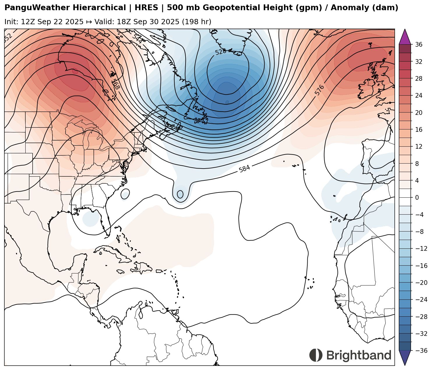
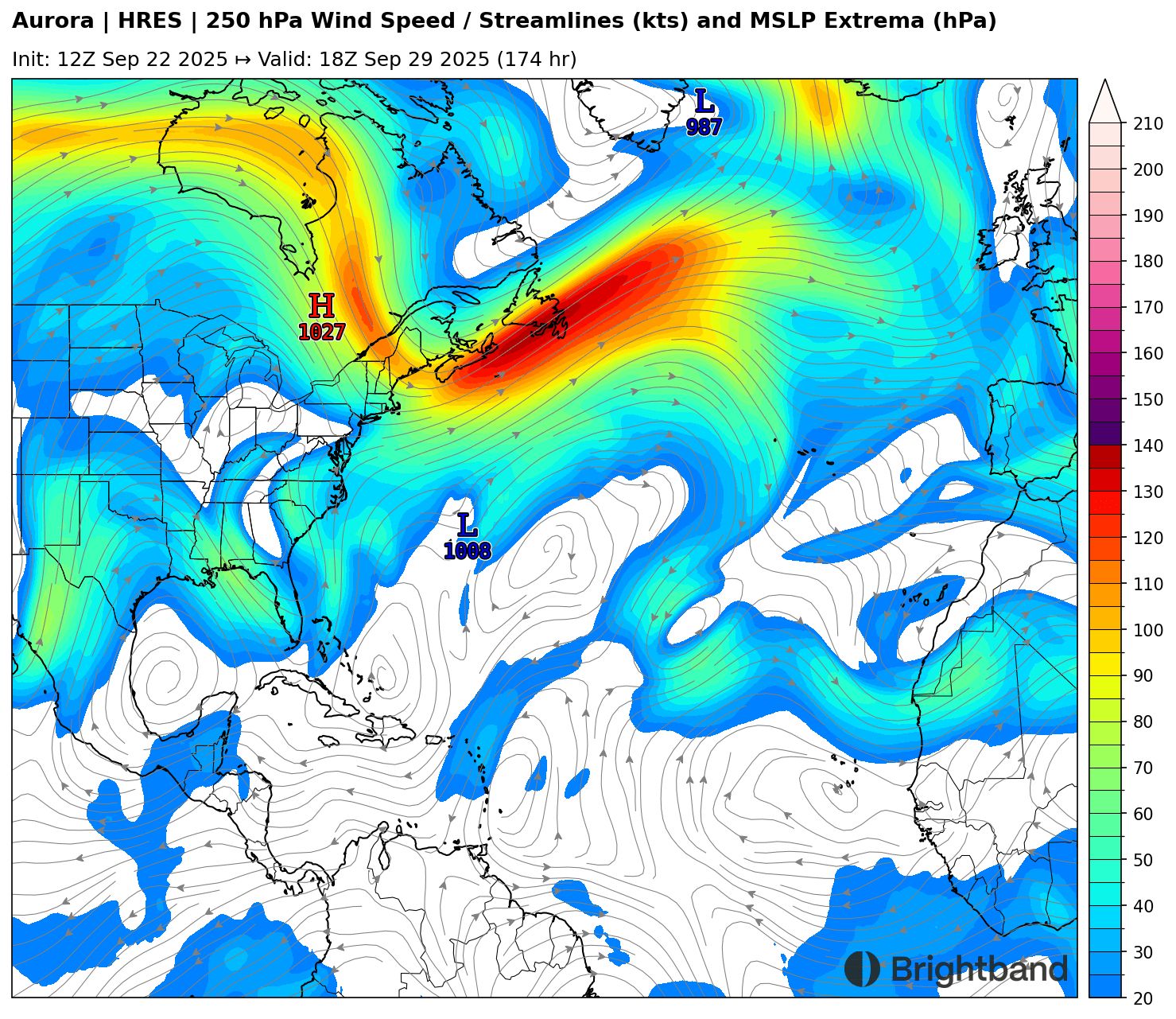
The Eastern system seems more likely to be strong, and could take a path fairly similar to Gabrielle, eventually recurving somewhere in the vicinity of Bermuda. It could be another case where the storm intensifies quickly as it recurves and interacts with a jet streak (Figure 5), although the upper winds may become favorable a little earlier than they did for Gabrielle. Certainly Bermuda should keep a close eye on this one. Hopefully they will continue to have luck dodging storms this year.
The leading wave has been a little more inconsistent in model signal, although Deepmind has been fairly aggressive in developing it. Earlier runs of AIFS were showing it potentially developing in the Northwest Caribbean, but recent runs seem to favor a track towards the Bahamas, where it may start to spin up. After this, it seems likely to get picked up and pulled north by a cutoff trough over the SE (Figure 6). The exact location of this trough relative to the storm and the US coast will likely determine how much of a threat this is to make landfall. The Carolinas and New England should definitely keep an eye out. There’s a lot of moving parts and a fairly complicated steering pattern. We’ll see how it evolves through the week.