Atlantic and East Pacific Tropical Discussion 9-8-2025
Atlantic
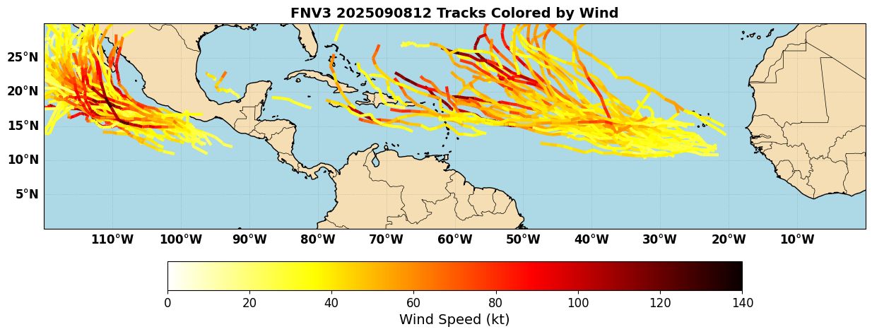
The Atlantic is remarkably quiet despite being near the climatological peak of the hurricane season. As we talked about last week, Invest 91L poofed out over the Central Atlantic, in a win for AI-based models like AIFS that were less aggressive on development. This week, both dynamical and AI models agree that the Atlantic is likely to remain quiet, as dry air and subsidence dominate. As we head into next week, some of the models are starting to once again pick up on a couple of waves for possible development. See, for example, the Google Deepmind FNV3 ensemble (Figure 1), which shows a relatively robust signal for some development of a couple of waves out over the Atlantic Main Development Region (MDR).
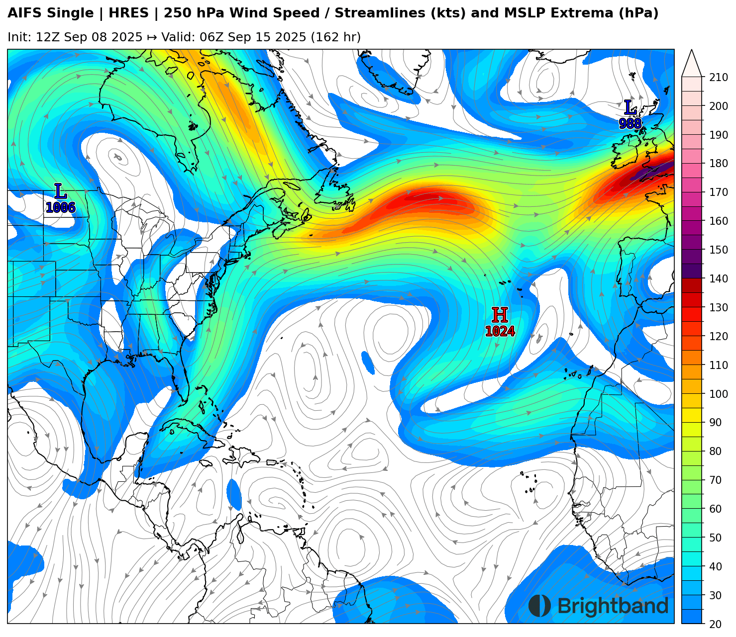
You may notice, however, that a lot of the tracks turn north quickly or seem to die out. That’s due to the fact that there is a lot of upper troughing across the Atlantic due to “anticylonic wavebreaking”. With a trough off the East Coast, and a ridge across the Central Atlantic, a lot of upper troughing is breaking off under this ridge and interfering with systems trying to move across the Atlantic (Figure 2). It remains to be seen if any of these waves can successfully move west and develop in this pattern.
East Pacific
The East Pacific, on the other hand, remains active. Hurricane Kiko is weakening and will miss the Hawaiian Islands to the north, but models show another system starting to develop south of Mexico. FNV3 (Figure 1) suggests that it could get strong, and the environment looks fairly favorable for development, with a large anticyclone aloft (Figure 3).
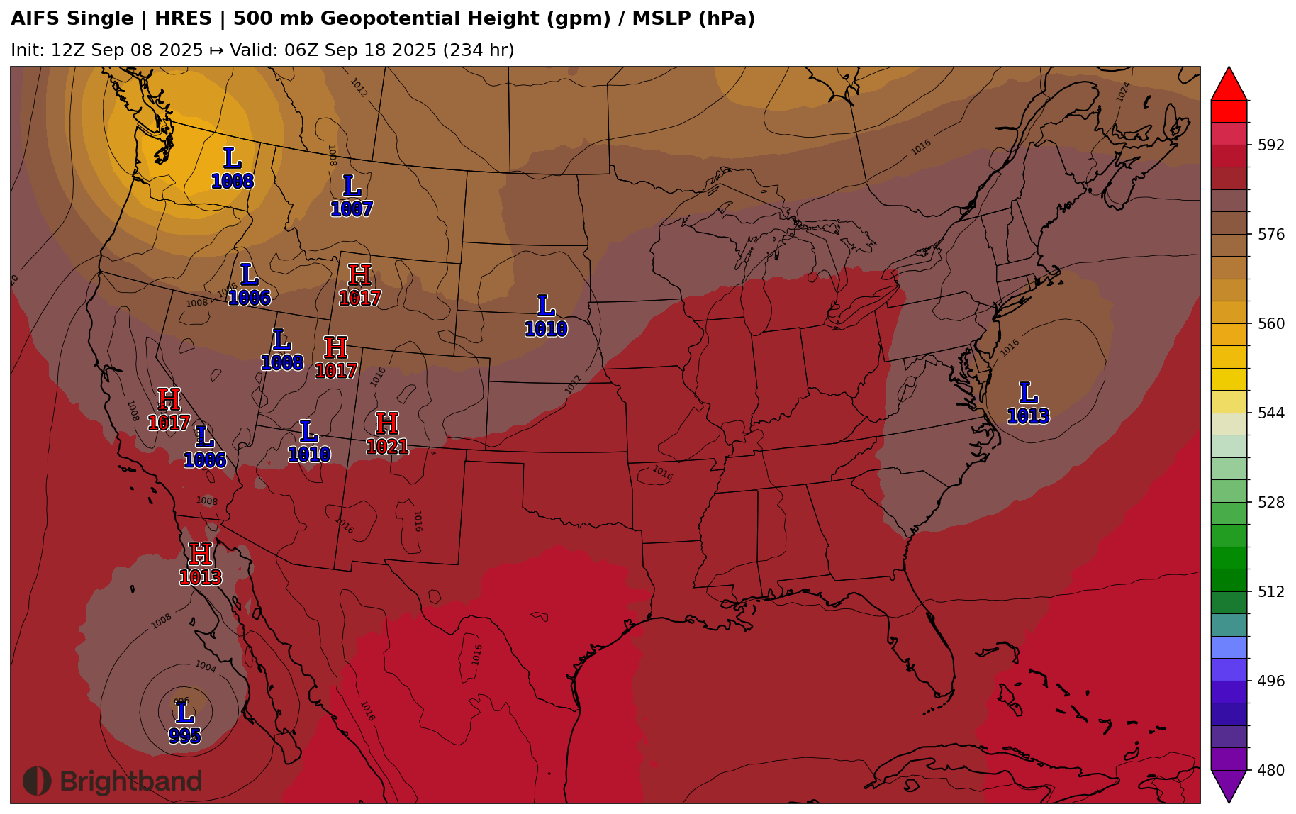
This system will need to be watched for impacts in Baja California, since a trough will be dipping down into the Western U.S. and may attempt to pull the system north, as seen in the AIFS (Figure 4). This is towards the extended part of the forecast, however (Days 8-9), so we will see how quickly the system forms and how the pattern evolves into this weekend and early next week.