Why Analyze AI Models for Tropical Cyclones?
AI is becoming popular across many fields, and meteorology is no exception. AI models are popping up all over the place at ECMWF, NCEP, and through private partnerships. For tropical cyclones, initial evaluations have shown promise with track, with more limited skill in intensity. AI models also seem to show promise at large-scale prediction, and so may be of use in assessing the large-scale forcing that TCs interact with. Our hope is to analyze AI model output of TCs (and potentially other weather phenomena) worldwide and bring exposure to motivate further evaluation and improvement.
AI Models Forecast Discussion 09-03-2025
We will dive into a few areas of interest, specifically Hurricane Kiko in the East/Central Pacific, Hurricane Lorena in the East Pacific, and an area of disturbed weather in the Central Atlantic.
Hurricane Kiko
Kiko is a small but potent hurricane over the East Pacific, moving towards the Central Pacific. It is a little surprising to get a storm like this with the equatorial Pacific progressing towards more of a La Niña setup, but with the MJO moving across the basin, it has helped to spark this system. It will move generally towards the west-northwest, and could pose a threat to the Hawaiian Islands. However, due to cool SST, shear, and dry air, it is likely to weaken significantly as it does so. AI models such as Google Deepmind agree with this scenario (Figure 1). This is the most common outcome for TCs approaching Hawaii from the East - typically the bigger threats are storms coming from the Southwest where water is warmer, such as Iniki in 1992. AI models agree with the dynamical models that this will not be that sort of threat, but it’s something to keep an eye on in the coming days.
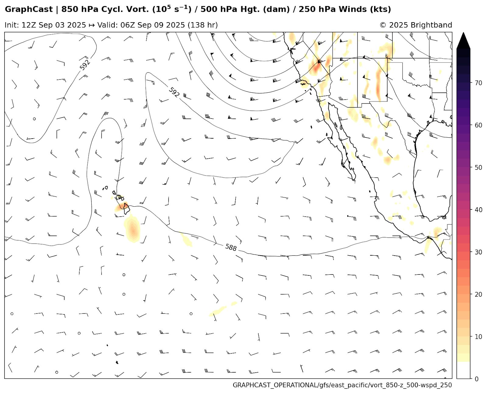
Hurricane Lorena
Lorena is another Pacific hurricane that is a slight threat to land, in this case to the Baja Peninsula of Mexico. The storm is going to recurve to the NE and move towards the Peninsula this weekend. Most models, including hurricane models, show the storm collapsing due to shear and cooler waters on approach. Aurora also shows this scenario, decoupling the system prior to reaching the coast (Figure 2).
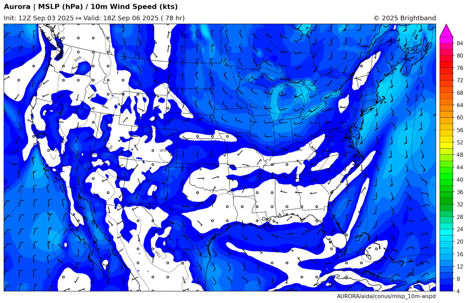
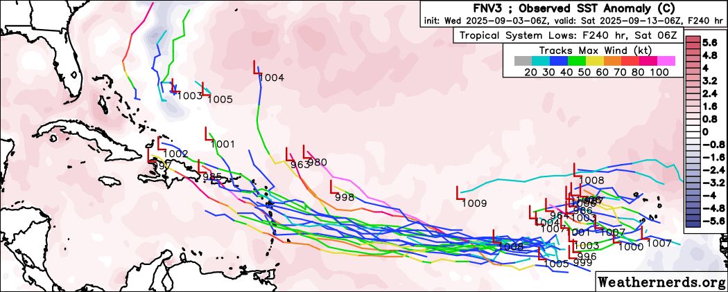
Atlantic Disturbance
The National Hurricane Center is currently tracking a disturbance over the Central Atlantic, giving it a 70% chance of TC formation within 7 days. The GFS and ECMWF are fairly aggressive on development, and bring the system near or north of the Leeward Islands by the middle of next week (Figure 3).
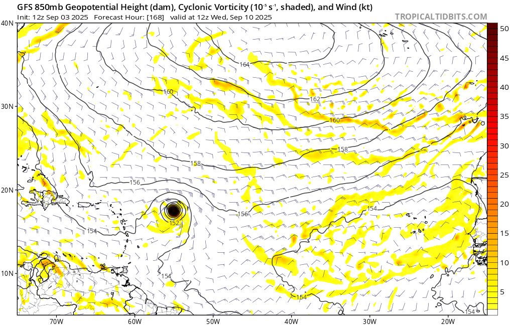
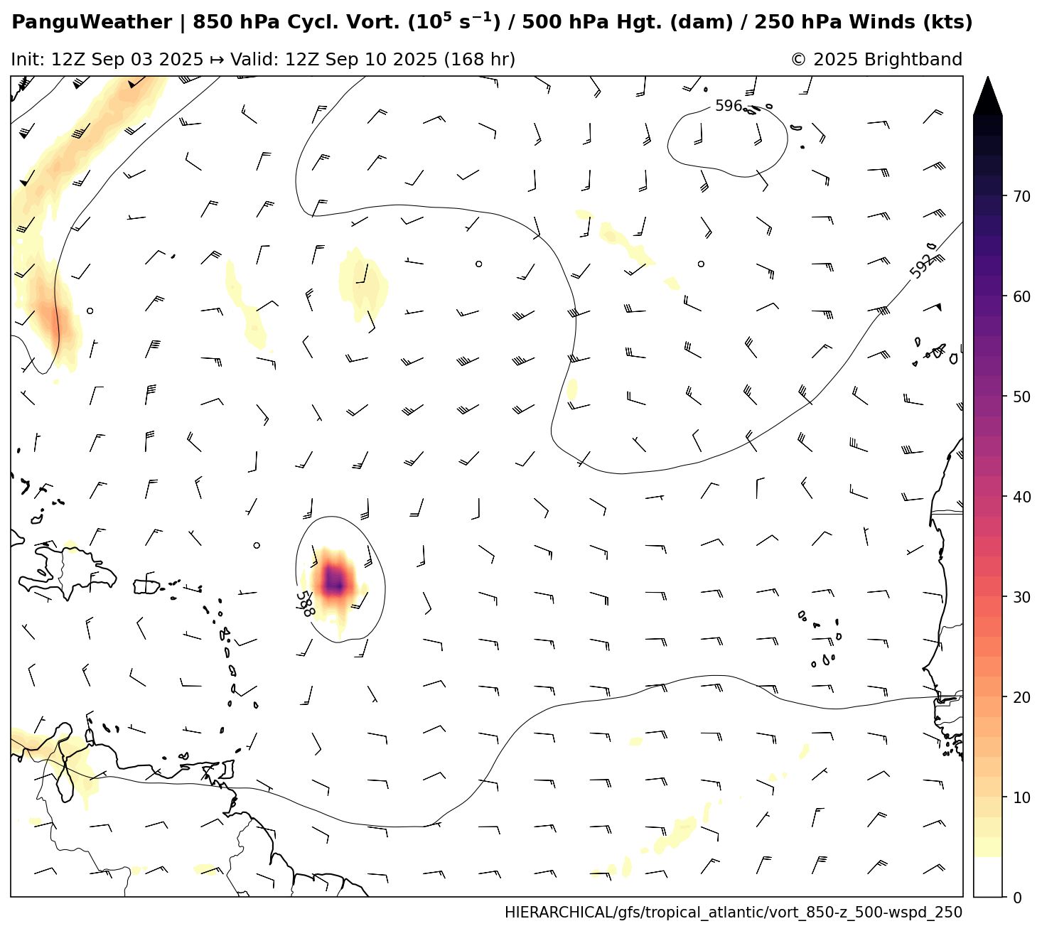
Some AI-based models are a little more tepid with development. The AIFS shows only a weak area of vorticity, with a more southerly track into the islands, but very little development. Pangu Weather is fairly similar to the operational GFS (Figure 4), showing a track NE of the Antilles. It is worth noting that the operational ECMWF, especially, is showing a very small vortex forming. There is a question of whether low-resolution AI models would be able to resolve such a feature, but it is also possible that some of them are simply showing a less favorable environment.
There are some potential obstacles for development, including the presence of an upper tropospheric trough (TUTT) in the SW Atlantic and some dry air. However, at peak season, and with the Madden Julian Oscillation (MJO) moving into the basin, I would be surprised if we don’t see any development. In terms of ensembles, the Google Deepmind has a lot of members picking up on the wave, but most of them losing it in the Eastern Caribbean (Figure 5). This will be an interesting test case for the TC genesis skill of the AI models against traditional dynamic models.