
A Tricky Forecast Ahead for 98L: AI Models Discussion 10-20-2025
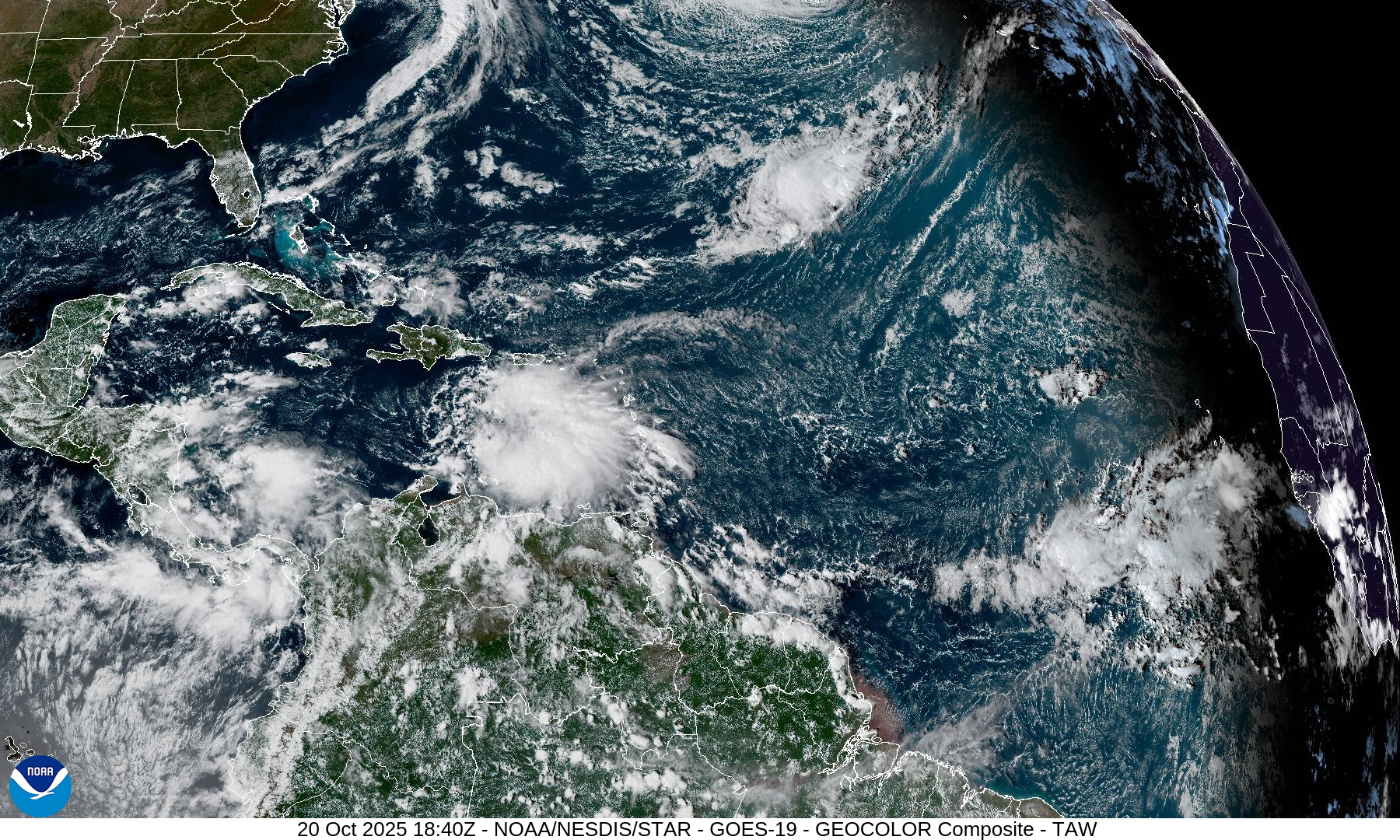
Invest 98L is currently moving through the Eastern Caribbean, and slowly getting organized. It has a 50% chance of development within 2 days, and 80% within 7 days, per NHC. The system is still battling some strong wind shear out of the west, though this is forecast to let up in the coming days.
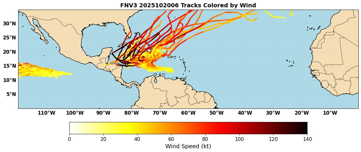
The main theme with the track forecast for 98L is “uncertainty”. A good illustration of this is the Google Deepmind/FNV3 ensemble track spread (Figure 1). Quite a few members show a quick turn NE into Hispaniola, but a sizable contingent also show the system missing the initial turn, and continuing west towards Jamaica or into the NW Caribbean before accelerating NE towards Cuba. It is also worth noting that the members that take it over the NW Caribbean get quite strong, which makes sense given the low shear and warmer water there.
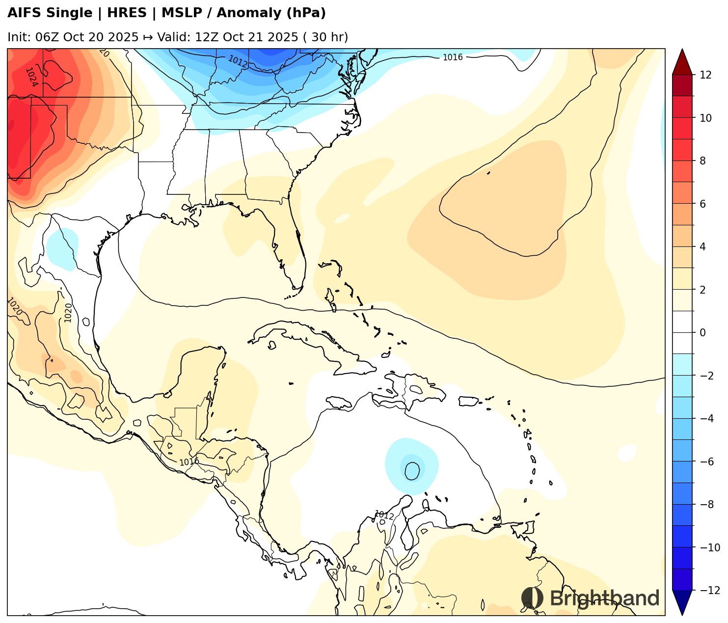
Individual AI models continue to show widely different solutions. For example, AIFS (Figure 2) follows the cluster towards Hispaniola and makes landfall near Haiti.
In contrast, Aurora follows the western idea and moves south of Jamaica and towards the NW Caribbean (Figure 3).
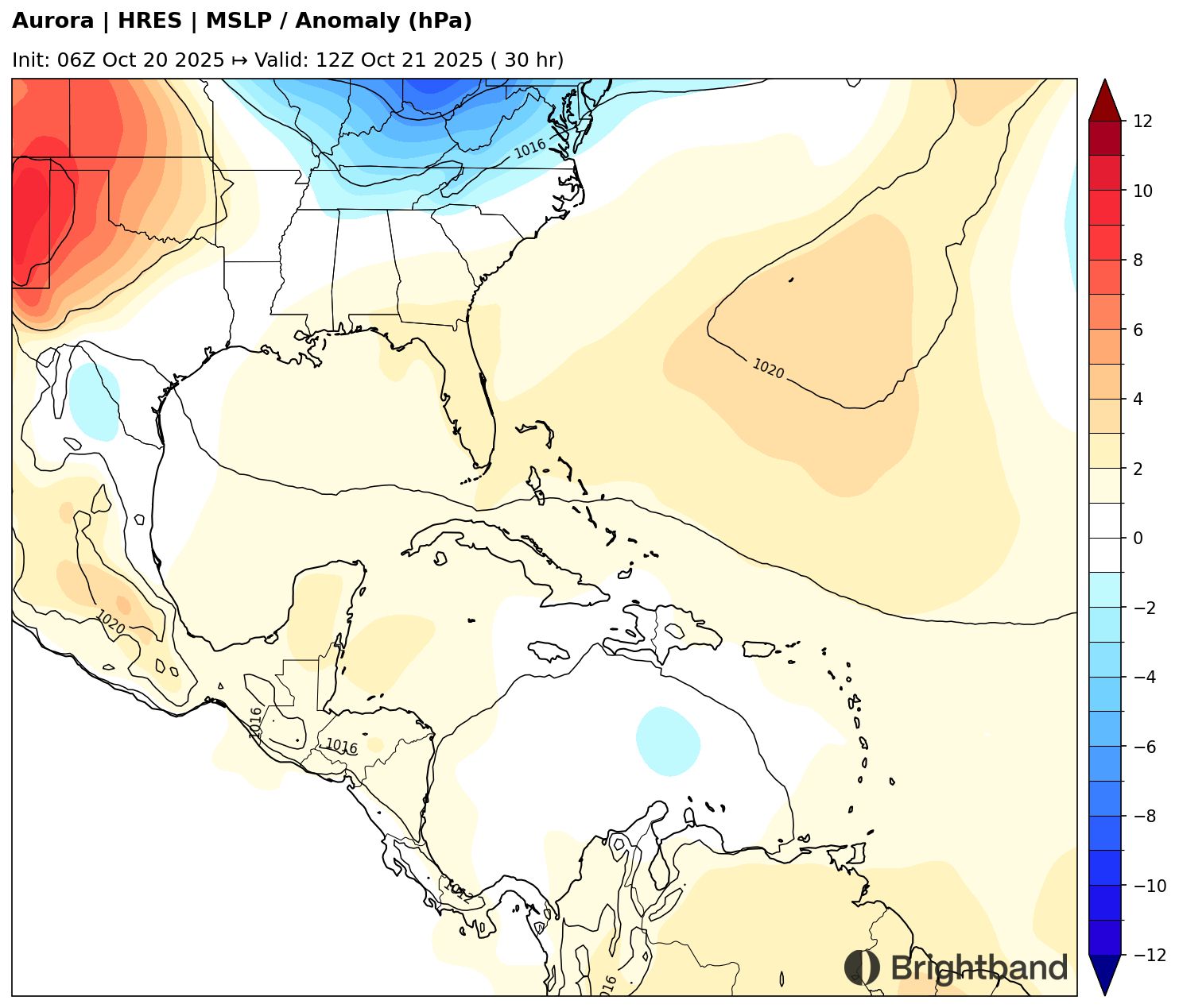
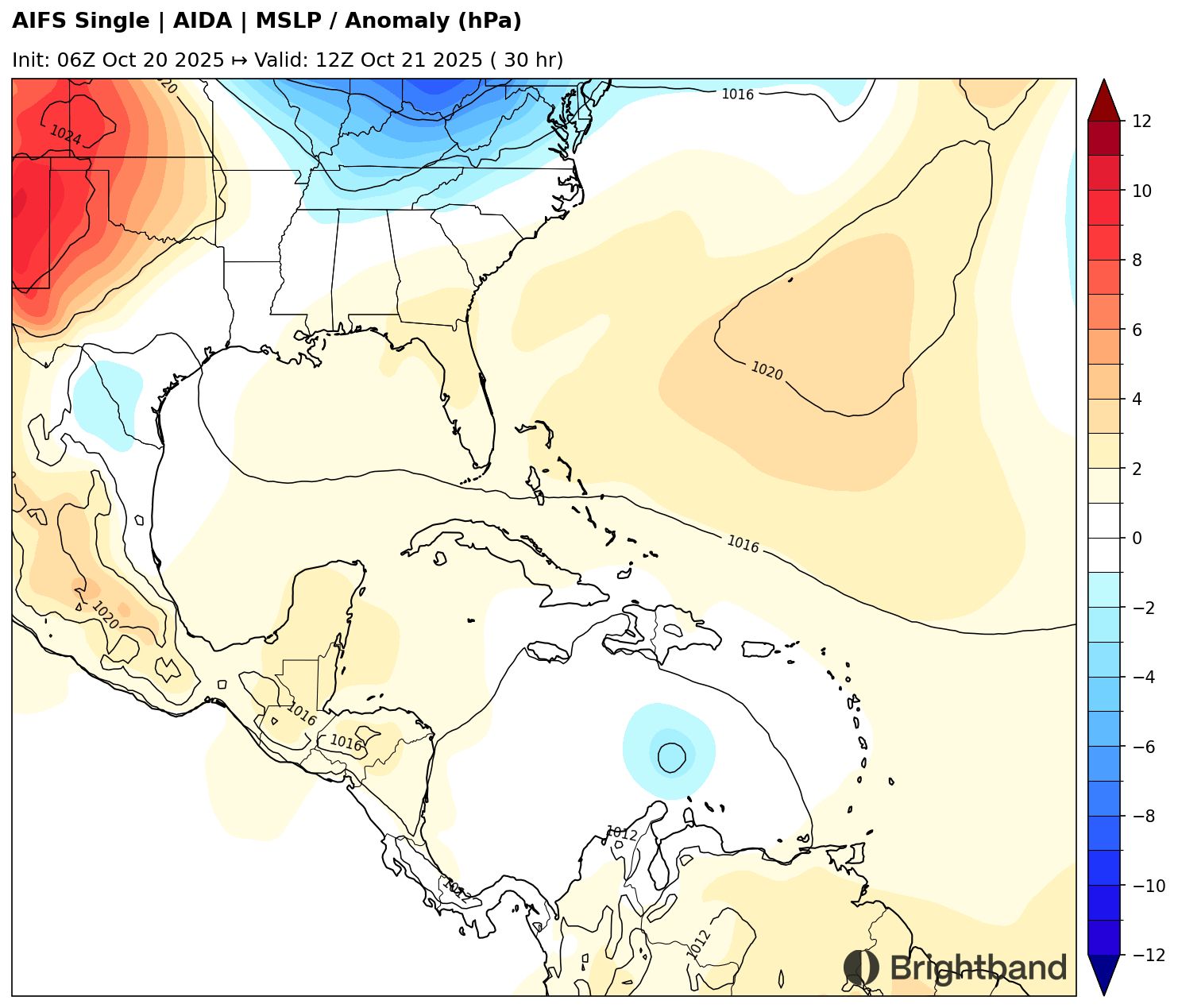
The differences in steering between these two models does not seem notably different in the short term. What seems important is the early intensity. For example, at 30h AIFS (Figure 4) has a stronger initial vortex than Aurora (Figure 5). This seems to be just enough for the system to feel the weakness in the subtropical ridge and move to the north. If the system is weaker initially, it may not feel this weakness and just continue west.

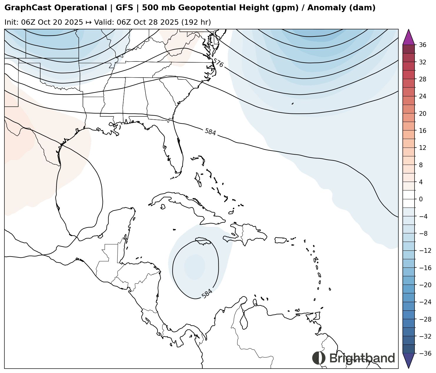
If 98L does miss the initial turn into the weakness and the trough passes it by to the northeast, we may get a period of slow motion toward the west as a ridge noses in from the west, but likely doesn’t fully capture the storm (Figure 6).
If this scenario does play out, we would likely see the potential for a very strong hurricane. The waters of the Caribbean are very warm, and models are forecasting the upper-level winds to be light and anticyclonic in the medium range, so there would be little shear over the storm further west (Figure 7).

Hispaniola Impacts
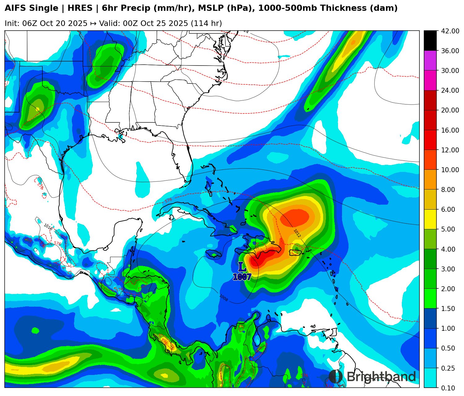
If 98L does end up moving into Hispaniola (or even gets close without making landfall), there is concern for a major flooding disaster. Models are showing a lot of rain on the downshear (east) side of the system, potentially with persistent training rainbands dumping rain over the same area for hours (Figure 8). This would be particularly problematic if the storm slows or stalls over the island as some runs have suggested.
In summary, there is still a lot of uncertainty with 98L! Hopefully as the system consolidates, things will come into better focus in the next day or two.