

05L forms in the Gulf, Lowell Moves Across the Pacific: AI Models Discussion 8-31-2026
We’ll take a look at TC activity across the globe today as we wrap up August, starting with the Atlantic.
Atlantic
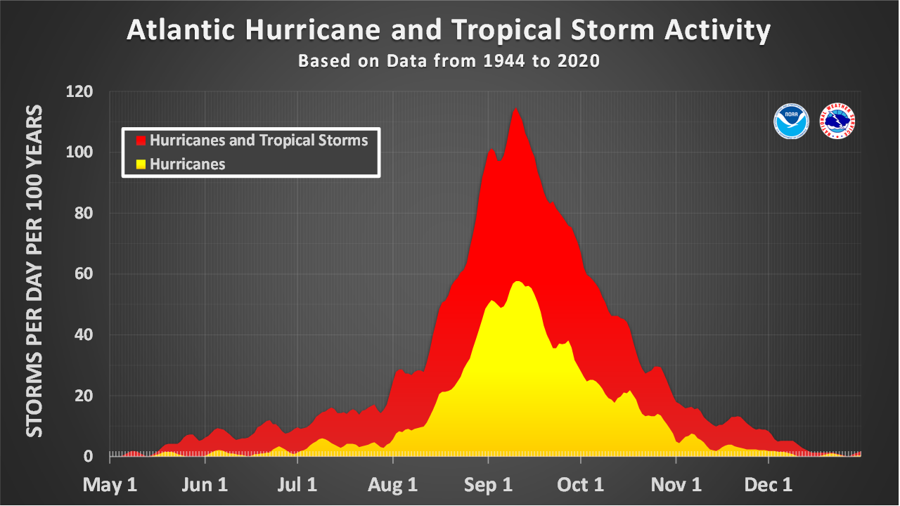
We are approaching the climatological peak of the Atlantic Hurricane season, though the basin is not overly active because of strong wind shear from El Niño. The remnants of TS Dolly fell apart near the Caribbean islands, and models have mostly dropped any development of that or other waves behind it (Figure 1).

The one system of note is TD5, which has formed over the North-Central Gulf. It will not last long before moving into the Texas coast, but some models do suggest it could intensify some before doing so (Figure 2), since the environment is generally favorable.

East Pacific
In contrast, the East and Central Pacific are very active, with Tropical Storm Lowell and Hurricane Karina active over the basin, and Invest 95E likely to also develop into a TC (Figure 3).

One interesting forecast question is the track of 95E after it develops. Dynamical models like the GFS are indicating it could head north and potentially bring flooding rain all the way into California, while AI models are generally showing it heading west away from land. This seems to be related to differences in steering. Both GFS (Figure 4) and AIGFS (Figure 5) show a trough to the north of the TC, but GFS shows a weaker ridge, whereas AIGFS shows a stronger ridge to the Northeast of the TC that is able to keep it heading west.


Further west, we will be watching to see how close Lowell gets to the Hawaiian Islands. Models are showing it turn north ahead of an upper-level trough (Figure 6), but right now most models are generally showing this turn happening when it is past Hawaii (Figure 3), and hinting at a turn back to the northwest after. This is still a ways out, though, so it will be worth monitoring. Karina could also try to get close to the islands, though it will likely be weakening substantially as it comes in from the East.

West Pacific
There are no strong systems in the West Pacific at the moment, but there are still hints that things will remain generally active over the next two weeks (Figure 7).

One system in particular that will be worth watching is Invest 94W to the south of Japan. Models are indicating this system may intensify some as it lifts north, with generally favorable upper-level winds and a possible favorable jet interaction (Figure 8).

We’ll keep an eye on systems across the Northern Hemisphere and be back with another update soon!